

Zell-W.-DurbachWeitblick-Brandeck
A cycling route starting in Ohlsbach, Baden-Wurttemberg, Germany.
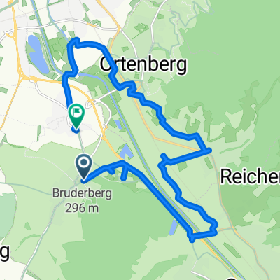
Overview
About this route
- -:--
- Duration
- 24.9 km
- Distance
- 640 m
- Ascent
- 643 m
- Descent
- ---
- Avg. speed
- ---
- Max. altitude

Route quality
Waytypes & surfaces along the route
Waytypes
Track
16.2 km
(65 %)
Quiet road
6.2 km
(25 %)
Surfaces
Paved
14.7 km
(59 %)
Unpaved
10.2 km
(41 %)
Asphalt
9.5 km
(38 %)
Gravel
7 km
(28 %)
Continue with Bikemap
Use, edit, or download this cycling route
You would like to ride Zell-W.-DurbachWeitblick-Brandeck or customize it for your own trip? Here is what you can do with this Bikemap route:
Free features
- Save this route as favorite or in collections
- Copy & plan your own version of this route
- Sync your route with Garmin or Wahoo
Premium features
Free trial for 3 days, or one-time payment. More about Bikemap Premium.
- Navigate this route on iOS & Android
- Export a GPX / KML file of this route
- Create your custom printout (try it for free)
- Download this route for offline navigation
Discover more Premium features.
Get Bikemap PremiumFrom our community
Other popular routes starting in Ohlsbach
 Hengstberg
- Distance
- 66.8 km
- Ascent
- 440 m
- Descent
- 442 m
- Location
- Ohlsbach, Baden-Wurttemberg, Germany
 Lange Ausfahrt durch Ohlsbach
- Distance
- 108.3 km
- Ascent
- 261 m
- Descent
- 259 m
- Location
- Ohlsbach, Baden-Wurttemberg, Germany
 Zell-W.-DurbachWeitblick-Brandeck
- Distance
- 24.9 km
- Ascent
- 640 m
- Descent
- 643 m
- Location
- Ohlsbach, Baden-Wurttemberg, Germany
 Schwarzwald-Tour
- Distance
- 161.9 km
- Ascent
- 2,004 m
- Descent
- 2,037 m
- Location
- Ohlsbach, Baden-Wurttemberg, Germany
 Ohlsbach-Rhein-Schutterzeller Mühle
- Distance
- 57.4 km
- Ascent
- 67 m
- Descent
- 106 m
- Location
- Ohlsbach, Baden-Wurttemberg, Germany
 Bellenwaldstraße nach Hebelstraße
- Distance
- 17.1 km
- Ascent
- 80 m
- Descent
- 91 m
- Location
- Ohlsbach, Baden-Wurttemberg, Germany
 Von Reichenbach bei Gengenbach auf das Hohe Horn und zurück
- Distance
- 23 km
- Ascent
- 652 m
- Descent
- 652 m
- Location
- Ohlsbach, Baden-Wurttemberg, Germany
 Kehl Ausfahrt
- Distance
- 55 km
- Ascent
- 53 m
- Descent
- 54 m
- Location
- Ohlsbach, Baden-Wurttemberg, Germany
Open it in the app