

Finsterrot: Dachsi Naturerlebnispfad
A cycling route starting in Wüstenrot, Baden-Wurttemberg, Germany.
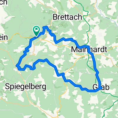
Overview
About this route
<p>Starting point: Wüstenrot (Finsterrot) - Alte Straße / B39 --> Forest parking Finsterroter See /</p>
<p>Hiking shoes /</p>
<p>At Finsterroter See: adventure playground, barefoot path and a kiosk with lake terrace.</p>
Translated, show original (German)- -:--
- Duration
- 2.7 km
- Distance
- 39 m
- Ascent
- 43 m
- Descent
- ---
- Avg. speed
- ---
- Max. altitude

Route quality
Waytypes & surfaces along the route
Waytypes
Track
1.6 km
(58 %)
Path
1.1 km
(42 %)
Surfaces
Paved
0.1 km
(5 %)
Unpaved
2.5 km
(94 %)
Ground
1.7 km
(62 %)
Unpaved (undefined)
0.6 km
(23 %)
Continue with Bikemap
Use, edit, or download this cycling route
You would like to ride Finsterrot: Dachsi Naturerlebnispfad or customize it for your own trip? Here is what you can do with this Bikemap route:
Free features
- Save this route as favorite or in collections
- Copy & plan your own version of this route
- Sync your route with Garmin or Wahoo
Premium features
Free trial for 3 days, or one-time payment. More about Bikemap Premium.
- Navigate this route on iOS & Android
- Export a GPX / KML file of this route
- Create your custom printout (try it for free)
- Download this route for offline navigation
Discover more Premium features.
Get Bikemap PremiumFrom our community
Other popular routes starting in Wüstenrot
 Finsterrot: Dachsi Naturerlebnispfad
- Distance
- 2.7 km
- Ascent
- 39 m
- Descent
- 43 m
- Location
- Wüstenrot, Baden-Wurttemberg, Germany
 Löwensteiner Berge (Steinknickle-Limes-Tobelschlucht-Silberstollen)
- Distance
- 38.9 km
- Ascent
- 656 m
- Descent
- 656 m
- Location
- Wüstenrot, Baden-Wurttemberg, Germany
 Rundweh:Neuh.- Stocksberg-Hirrweiler-Neuh.
- Distance
- 22.2 km
- Ascent
- 472 m
- Descent
- 467 m
- Location
- Wüstenrot, Baden-Wurttemberg, Germany
 Wüstenrot - Willsbach - Wüstenrot
- Distance
- 32.4 km
- Ascent
- 526 m
- Descent
- 524 m
- Location
- Wüstenrot, Baden-Wurttemberg, Germany
 Heimstrecke
- Distance
- 16.5 km
- Ascent
- 310 m
- Descent
- 302 m
- Location
- Wüstenrot, Baden-Wurttemberg, Germany
 Rundweg von Neuhütten nach Schwäbisch Hall und zurück
- Distance
- 62.8 km
- Ascent
- 706 m
- Descent
- 735 m
- Location
- Wüstenrot, Baden-Wurttemberg, Germany
 Wüstenrot-Mainhardt-Wüstenrot
- Distance
- 28 km
- Ascent
- 243 m
- Descent
- 244 m
- Location
- Wüstenrot, Baden-Wurttemberg, Germany
 Kurzstrecke Rundweg Neuhütten - Mainhardt - Wüstenrot
- Distance
- 23.5 km
- Ascent
- 312 m
- Descent
- 314 m
- Location
- Wüstenrot, Baden-Wurttemberg, Germany
Open it in the app