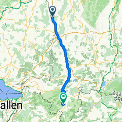
Kellmünz-Rothtal-Weissenhorn-Balzheim
A cycling route starting in Altenstadt, Bavaria, Germany.
Overview
About this route
Diese Tour folgt einer Teilstrecke an der Roth entlang von Babenhausen nach Weissenhorn. Quasi als Anlauf zum Rothtal wird eine sehr schöne Bahn Trasse befahren. Die ehemalige Rothtal-Günz Bahnstrecke von Kellmünz nach Babenhausen. (Tourbeschreibung unter: thod_er@gmx.de)
- -:--
- Duration
- 65.8 km
- Distance
- 34,919 m
- Ascent
- 34,919 m
- Descent
- ---
- Avg. speed
- 586 m
- Avg. speed
Route quality
Waytypes & surfaces along the route
Waytypes
Track
21.8 km
(33 %)
Path
19.8 km
(30 %)
Surfaces
Paved
42.9 km
(65 %)
Unpaved
17.7 km
(27 %)
Asphalt
38.2 km
(58 %)
Gravel
15.9 km
(24 %)
Continue with Bikemap
Use, edit, or download this cycling route
You would like to ride Kellmünz-Rothtal-Weissenhorn-Balzheim or customize it for your own trip? Here is what you can do with this Bikemap route:
Free features
- Save this route as favorite or in collections
- Copy & plan your own version of this route
- Sync your route with Garmin or Wahoo
Premium features
Free trial for 3 days, or one-time payment. More about Bikemap Premium.
- Navigate this route on iOS & Android
- Export a GPX / KML file of this route
- Create your custom printout (try it for free)
- Download this route for offline navigation
Discover more Premium features.
Get Bikemap PremiumFrom our community
Other popular routes starting in Altenstadt
- Abendroute
- Distance
- 20.7 km
- Ascent
- 47 m
- Descent
- 60 m
- Location
- Altenstadt, Bavaria, Germany
- Mittlere Route Balzheim-Biberach (Riß)
- Distance
- 32.5 km
- Ascent
- 434 m
- Descent
- 391 m
- Location
- Altenstadt, Bavaria, Germany
- Mitterfeldstraße 26, Altenstadt nach Mitterfeldstraße 26, Altenstadt
- Distance
- 21.9 km
- Ascent
- 220 m
- Descent
- 220 m
- Location
- Altenstadt, Bavaria, Germany
- Iller 4
- Distance
- 57 km
- Ascent
- 292 m
- Descent
- 161 m
- Location
- Altenstadt, Bavaria, Germany
- Kellmünz-Rothtal-Weissenhorn-Balzheim
- Distance
- 65.8 km
- Ascent
- 34,919 m
- Descent
- 34,919 m
- Location
- Altenstadt, Bavaria, Germany
- Waldrunde Kirchberg
- Distance
- 30.6 km
- Ascent
- 345 m
- Descent
- 340 m
- Location
- Altenstadt, Bavaria, Germany
- 7 Illertissen- Lindau
- Distance
- 99.3 km
- Ascent
- 466 m
- Descent
- 592 m
- Location
- Altenstadt, Bavaria, Germany
- Boos Pfadies 2
- Distance
- 34.7 km
- Ascent
- 266 m
- Descent
- 254 m
- Location
- Altenstadt, Bavaria, Germany
Open it in the app