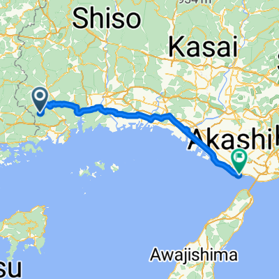
赤穂の歴史をめぐるコース
A cycling route starting in Kariya, Hyōgo, Japan.
Overview
About this route
- -:--
- Duration
- 4.9 km
- Distance
- 8 m
- Ascent
- 8 m
- Descent
- ---
- Avg. speed
- ---
- Max. altitude
Route quality
Waytypes & surfaces along the route
Waytypes
Busy road
2.4 km
(48 %)
Road
1.7 km
(35 %)
Continue with Bikemap
Use, edit, or download this cycling route
You would like to ride 赤穂の歴史をめぐるコース or customize it for your own trip? Here is what you can do with this Bikemap route:
Free features
- Save this route as favorite or in collections
- Copy & plan your own version of this route
- Sync your route with Garmin or Wahoo
Premium features
Free trial for 3 days, or one-time payment. More about Bikemap Premium.
- Navigate this route on iOS & Android
- Export a GPX / KML file of this route
- Create your custom printout (try it for free)
- Download this route for offline navigation
Discover more Premium features.
Get Bikemap PremiumFrom our community
Other popular routes starting in Kariya
- 赤穂の歴史をめぐるコース
- Distance
- 4.9 km
- Ascent
- 8 m
- Descent
- 8 m
- Location
- Kariya, Hyōgo, Japan
- 日本遺産・坂越浦を巡るコース
- Distance
- 3.9 km
- Ascent
- 96 m
- Descent
- 95 m
- Location
- Kariya, Hyōgo, Japan
- Uno-Ako
- Distance
- 73 km
- Ascent
- 495 m
- Descent
- 500 m
- Location
- Kariya, Hyōgo, Japan
- 片鉄ロマン街道
- Distance
- 70.7 km
- Ascent
- 1,242 m
- Descent
- 1,142 m
- Location
- Kariya, Hyōgo, Japan
- 赤穂〜鳥取砂丘 片道
- Distance
- 121.5 km
- Ascent
- 615 m
- Descent
- 612 m
- Location
- Kariya, Hyōgo, Japan
- Day 32: Himeji
- Distance
- 46.5 km
- Ascent
- 196 m
- Descent
- 202 m
- Location
- Kariya, Hyōgo, Japan
- 片鉄ロマン街道ルート _01 (Hinase start)
- Distance
- 36.5 km
- Ascent
- 178 m
- Descent
- 130 m
- Location
- Kariya, Hyōgo, Japan
- 頭島から湯郷
- Distance
- 58.7 km
- Ascent
- 990 m
- Descent
- 932 m
- Location
- Kariya, Hyōgo, Japan
Open it in the app