

Sono, Kecamatan Buduran to Irianjaya, Buduran
A cycling route starting in Buduran, East Java, Indonesia.
Overview
About this route
- 1 h 37 min
- Duration
- 33.2 km
- Distance
- 165 m
- Ascent
- 164 m
- Descent
- 20.5 km/h
- Avg. speed
- ---
- Max. altitude

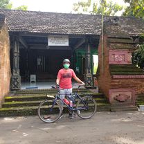
Route photos


Continue with Bikemap
Use, edit, or download this cycling route
You would like to ride Sono, Kecamatan Buduran to Irianjaya, Buduran or customize it for your own trip? Here is what you can do with this Bikemap route:
Free features
- Save this route as favorite or in collections
- Copy & plan your own version of this route
- Sync your route with Garmin or Wahoo
Premium features
Free trial for 3 days, or one-time payment. More about Bikemap Premium.
- Navigate this route on iOS & Android
- Export a GPX / KML file of this route
- Create your custom printout (try it for free)
- Download this route for offline navigation
Discover more Premium features.
Get Bikemap PremiumFrom our community
Other popular routes starting in Buduran
 Jalan Raya Saimbang, Kecamatan Sukodono to HM3P+6QQ, Kecamatan Sidoarjo
- Distance
- 4.6 km
- Ascent
- 7 m
- Descent
- 11 m
- Location
- Buduran, East Java, Indonesia
 Buduran - Situs Candi Terung
- Distance
- 33.3 km
- Ascent
- 20,042 m
- Descent
- 26 m
- Location
- Buduran, East Java, Indonesia
 taman dhika blok D-7
- Distance
- 0 km
- Ascent
- 0 m
- Descent
- 0 m
- Location
- Buduran, East Java, Indonesia
 HMJ9+67X, Kecamatan Sukodono to Bogem, Kecamatan Sukodono
- Distance
- 15.9 km
- Ascent
- 94 m
- Descent
- 102 m
- Location
- Buduran, East Java, Indonesia
 Jalan Stadion 99, Kecamatan Sidoarjo to Jalan Stadion 3 13, Kecamatan Sidoarjo
- Distance
- 10 km
- Ascent
- 112 m
- Descent
- 109 m
- Location
- Buduran, East Java, Indonesia
 Sono, Kecamatan Buduran to Irianjaya, Buduran
- Distance
- 33.2 km
- Ascent
- 165 m
- Descent
- 164 m
- Location
- Buduran, East Java, Indonesia
 Jalan Pulo Seloko No.22, Kecamatan Buduran to JH 13 No. 01, Buduran
- Distance
- 23.7 km
- Ascent
- 227 m
- Descent
- 228 m
- Location
- Buduran, East Java, Indonesia
 Bogem, Kecamatan Sukodono to Bogem, Kecamatan Sukodono
- Distance
- 12.9 km
- Ascent
- 17 m
- Descent
- 16 m
- Location
- Buduran, East Java, Indonesia
Open it in the app