

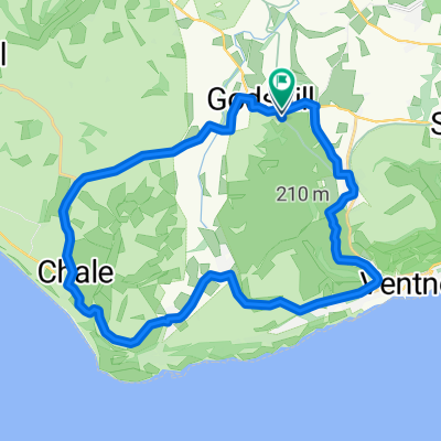
Ravens Route 21.2 miles.
A cycling route starting in Ventnor, England, United Kingdom.
Overview
About this route
Enjoying the slow climb to Blackgang view point, I often see ravens along this stretch. Today a very nosy pheasant watched from the roadside. Best descending sections: Upper Ventnor to the Undercliffe but watch the junction between Gills Cliff Road & Castle Road (traffic lights). Institute Hill, Niton (short but sweet!). Blackgang view point to Chale Street, fast with only one roundabout & Berry Shute to Highwood Lane, Chillerton. In order to extend this route to over 20 miles, take the Niton Road, just before Rookley to cut down through Beacon Alley which joins the Whitwell Road back to Godshill & Wroxall. Enjoy.
- -:--
- Duration
- 48.6 km
- Distance
- 420 m
- Ascent
- 428 m
- Descent
- ---
- Avg. speed
- ---
- Avg. speed

Route quality
Waytypes & surfaces along the route
Waytypes
Road
22.3 km
(46 %)
Busy road
18.3 km
(38 %)
Surfaces
Paved
46.9 km
(96 %)
Unpaved
0.4 km
(<1 %)
Asphalt
46.9 km
(96 %)
Loose gravel
0.2 km
(<1 %)
Continue with Bikemap
Use, edit, or download this cycling route
You would like to ride Ravens Route 21.2 miles. or customize it for your own trip? Here is what you can do with this Bikemap route:
Free features
- Save this route as favorite or in collections
- Copy & plan your own version of this route
- Sync your route with Garmin or Wahoo
Premium features
Free trial for 3 days, or one-time payment. More about Bikemap Premium.
- Navigate this route on iOS & Android
- Export a GPX / KML file of this route
- Create your custom printout (try it for free)
- Download this route for offline navigation
Discover more Premium features.
Get Bikemap PremiumFrom our community
Other popular routes starting in Ventnor
 Chalk Ridge Extreme Route
- Distance
- 93.2 km
- Ascent
- 1,115 m
- Descent
- 1,114 m
- Location
- Ventnor, England, United Kingdom
 IOW 17 mile
- Distance
- 25.6 km
- Ascent
- 252 m
- Descent
- 263 m
- Location
- Ventnor, England, United Kingdom
 Little Loop
- Distance
- 20.2 km
- Ascent
- 135 m
- Descent
- 136 m
- Location
- Ventnor, England, United Kingdom
 Chillerton Tour - Via Whitwell & Roud
- Distance
- 35.4 km
- Ascent
- 347 m
- Descent
- 348 m
- Location
- Ventnor, England, United Kingdom
 Ravens Route 21.2 miles.
- Distance
- 48.6 km
- Ascent
- 420 m
- Descent
- 428 m
- Location
- Ventnor, England, United Kingdom
 Chillerton Loop
- Distance
- 28.6 km
- Ascent
- 291 m
- Descent
- 290 m
- Location
- Ventnor, England, United Kingdom
 Alverstone Bombing Run
- Distance
- 17.6 km
- Ascent
- 124 m
- Descent
- 122 m
- Location
- Ventnor, England, United Kingdom
 Wroxall Rookley Wroxall
- Distance
- 22.4 km
- Ascent
- 207 m
- Descent
- 195 m
- Location
- Ventnor, England, United Kingdom
Open it in the app