

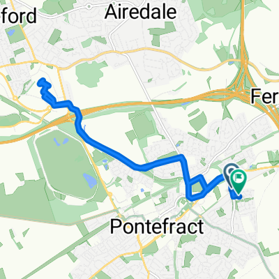
Queen's Square 59 to Celandine Close 19
A cycling route starting in Pontefract, England, United Kingdom.
Overview
About this route
- 8 min
- Duration
- 2.9 km
- Distance
- 8 m
- Ascent
- 38 m
- Descent
- 22.2 km/h
- Avg. speed
- ---
- Max. altitude

Route photos

Route quality
Waytypes & surfaces along the route
Waytypes
Quiet road
1.3 km
(46 %)
Pedestrian area
1.1 km
(40 %)
Surfaces
Paved
1.2 km
(42 %)
Asphalt
1.2 km
(42 %)
Undefined
1.7 km
(58 %)
Continue with Bikemap
Use, edit, or download this cycling route
You would like to ride Queen's Square 59 to Celandine Close 19 or customize it for your own trip? Here is what you can do with this Bikemap route:
Free features
- Save this route as favorite or in collections
- Copy & plan your own version of this route
- Sync your route with Garmin or Wahoo
Premium features
Free trial for 3 days, or one-time payment. More about Bikemap Premium.
- Navigate this route on iOS & Android
- Export a GPX / KML file of this route
- Create your custom printout (try it for free)
- Download this route for offline navigation
Discover more Premium features.
Get Bikemap PremiumFrom our community
Other popular routes starting in Pontefract
 Queen's Square 59 to Celandine Close 19
- Distance
- 2.9 km
- Ascent
- 8 m
- Descent
- 38 m
- Location
- Pontefract, England, United Kingdom
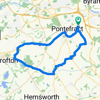
 Aberford and Lumby
- Distance
- 68.4 km
- Ascent
- 279 m
- Descent
- 275 m
- Location
- Pontefract, England, United Kingdom
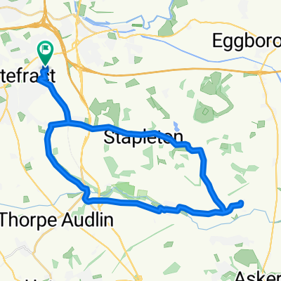
 Nostell clockwise
- Distance
- 28.6 km
- Ascent
- 253 m
- Descent
- 254 m
- Location
- Pontefract, England, United Kingdom
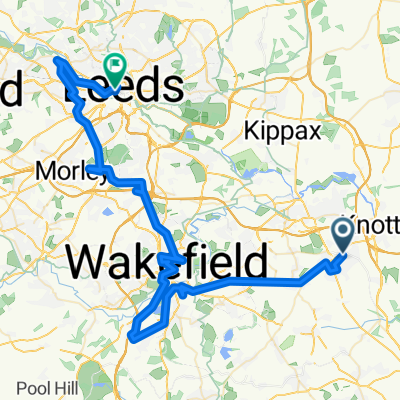 Ali's Phoenix Ride
- Distance
- 66.8 km
- Ascent
- 319 m
- Descent
- 320 m
- Location
- Pontefract, England, United Kingdom
 Stubbs Walden
- Distance
- 27.8 km
- Ascent
- 211 m
- Descent
- 217 m
- Location
- Pontefract, England, United Kingdom
 Norton
- Distance
- 28.1 km
- Ascent
- 190 m
- Descent
- 190 m
- Location
- Pontefract, England, United Kingdom
 junction 32
- Distance
- 11 km
- Ascent
- 121 m
- Descent
- 121 m
- Location
- Pontefract, England, United Kingdom
 the route home
- Distance
- 9.7 km
- Ascent
- 77 m
- Descent
- 80 m
- Location
- Pontefract, England, United Kingdom
Open it in the app