

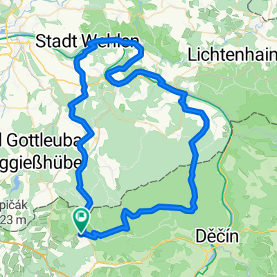
Tisá - Altenberg a zpět
A cycling route starting in Libouchec, Ústecký kraj, Czechia.
Overview
About this route
Čím více zde napíšete informací, tím více bude užitečnější pro ostatním uživatele.<br /><br />* Průběh trasy.<br />* Co je zvláštní na této trase?<br />* Proč doporučit tuto trasu?<br />* Co se Vám zde nejvíce líbilo?<br />* Atd.
- -:--
- Duration
- 60.2 km
- Distance
- 804 m
- Ascent
- 806 m
- Descent
- ---
- Avg. speed
- ---
- Max. altitude
Route quality
Waytypes & surfaces along the route
Waytypes
Road
25.9 km
(43 %)
Quiet road
6.6 km
(11 %)
Surfaces
Paved
44.5 km
(74 %)
Unpaved
3.6 km
(6 %)
Asphalt
43.9 km
(73 %)
Gravel
3.6 km
(6 %)
Continue with Bikemap
Use, edit, or download this cycling route
You would like to ride Tisá - Altenberg a zpět or customize it for your own trip? Here is what you can do with this Bikemap route:
Free features
- Save this route as favorite or in collections
- Copy & plan your own version of this route
- Sync your route with Garmin or Wahoo
Premium features
Free trial for 3 days, or one-time payment. More about Bikemap Premium.
- Navigate this route on iOS & Android
- Export a GPX / KML file of this route
- Create your custom printout (try it for free)
- Download this route for offline navigation
Discover more Premium features.
Get Bikemap PremiumFrom our community
Other popular routes starting in Libouchec
 Tisá, Tisá do Tisá, Tisá
- Distance
- 20.4 km
- Ascent
- 547 m
- Descent
- 544 m
- Location
- Libouchec, Ústecký kraj, Czechia
 HRH_2008_den_8
- Distance
- 44.2 km
- Ascent
- 489 m
- Descent
- 794 m
- Location
- Libouchec, Ústecký kraj, Czechia
 Tisá - Altenberg a zpět
- Distance
- 60.2 km
- Ascent
- 804 m
- Descent
- 806 m
- Location
- Libouchec, Ústecký kraj, Czechia
 Sněžník Trail
- Distance
- 38.6 km
- Ascent
- 668 m
- Descent
- 683 m
- Location
- Libouchec, Ústecký kraj, Czechia
 Tisa-Lilienstein
- Distance
- 76.3 km
- Ascent
- 863 m
- Descent
- 1,039 m
- Location
- Libouchec, Ústecký kraj, Czechia
 Tisa - Pirna
- Distance
- 64.2 km
- Ascent
- 281 m
- Descent
- 686 m
- Location
- Libouchec, Ústecký kraj, Czechia
 Emilova cesta
- Distance
- 8.1 km
- Ascent
- 311 m
- Descent
- 317 m
- Location
- Libouchec, Ústecký kraj, Czechia
 GIRO DI BEER - Libouchec 2011
- Distance
- 46.1 km
- Ascent
- 761 m
- Descent
- 761 m
- Location
- Libouchec, Ústecký kraj, Czechia
Open it in the app