

Major MacKenzie to Musselman Lake
A cycling route starting in Markham, Ontario, Canada.
Overview
About this route
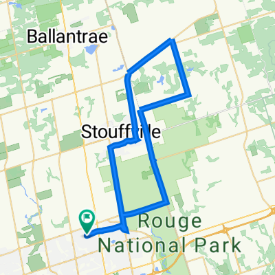
Start at Major MacKenzie in the Angus Glen Community Centre paring lot. Heading north towards Musselman Lake. Break or Lunch in Goodwood at Annina's Bakeshop, then return.
- -:--
- Duration
- 67.7 km
- Distance
- 287 m
- Ascent
- 287 m
- Descent
- ---
- Avg. speed
- ---
- Max. altitude
Route quality
Waytypes & surfaces along the route
Waytypes
Road
28.4 km
(42 %)
Quiet road
11.5 km
(17 %)
Surfaces
Paved
67.7 km
(100 %)
Asphalt
58.9 km
(87 %)
Paved (undefined)
8.8 km
(13 %)
Route highlights
Points of interest along the route
Point of interest after 39.7 km
Goodwood Cafe
Continue with Bikemap
Use, edit, or download this cycling route
You would like to ride Major MacKenzie to Musselman Lake or customize it for your own trip? Here is what you can do with this Bikemap route:
Free features
- Save this route as favorite or in collections
- Copy & plan your own version of this route
- Sync your route with Garmin or Wahoo
Premium features
Free trial for 3 days, or one-time payment. More about Bikemap Premium.
- Navigate this route on iOS & Android
- Export a GPX / KML file of this route
- Create your custom printout (try it for free)
- Download this route for offline navigation
Discover more Premium features.
Get Bikemap PremiumFrom our community
Other popular routes starting in Markham
 Unionville to Organics Farm Via Rouge River Trail
- Distance
- 37.5 km
- Ascent
- 177 m
- Descent
- 150 m
- Location
- Markham, Ontario, Canada
 115km loop with 3 Gas Statiosn for Break
- Distance
- 118.7 km
- Ascent
- 409 m
- Descent
- 409 m
- Location
- Markham, Ontario, Canada
 Reesor to Chalk Lake
- Distance
- 62.4 km
- Ascent
- 352 m
- Descent
- 357 m
- Location
- Markham, Ontario, Canada
 Randonneur Brevet - Scugog Circle - 200 k
- Distance
- 206.6 km
- Ascent
- 872 m
- Descent
- 838 m
- Location
- Markham, Ontario, Canada
 Saturday Ride
- Distance
- 78.8 km
- Ascent
- 389 m
- Descent
- 349 m
- Location
- Markham, Ontario, Canada
 32 km Bur Oak, Reesor Rd, 14th Ave, Birchmont Rd, Village Pkwy, 16th Ave, The Bridle Walk, Casltemore Ave
- Distance
- 31.8 km
- Ascent
- 94 m
- Descent
- 94 m
- Location
- Markham, Ontario, Canada
 多倫多單車谷 -- ANNINA BAKERY
- Distance
- 45.6 km
- Ascent
- 298 m
- Descent
- 297 m
- Location
- Markham, Ontario, Canada
 110 Km Ride on Warden to Base Line
- Distance
- 110 km
- Ascent
- 294 m
- Descent
- 294 m
- Location
- Markham, Ontario, Canada
Open it in the app