

Overview
About this route
- -:--
- Duration
- 77.7 km
- Distance
- 304 m
- Ascent
- 330 m
- Descent
- ---
- Avg. speed
- ---
- Max. altitude

Part of
ascension 2020
11 stages
Continue with Bikemap
Use, edit, or download this cycling route
You would like to ride fecamp honfleur or customize it for your own trip? Here is what you can do with this Bikemap route:
Free features
- Save this route as favorite or in collections
- Copy & plan your own version of this route
- Sync your route with Garmin or Wahoo
Premium features
Free trial for 3 days, or one-time payment. More about Bikemap Premium.
- Navigate this route on iOS & Android
- Export a GPX / KML file of this route
- Create your custom printout (try it for free)
- Download this route for offline navigation
Discover more Premium features.
Get Bikemap PremiumFrom our community
Other popular routes starting in Fécamp
 fecamp dieppe
- Distance
- 85.7 km
- Ascent
- 569 m
- Descent
- 530 m
- Location
- Fécamp, Normandy, France
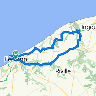
 PALUEL
- Distance
- 113 km
- Ascent
- 537 m
- Descent
- 529 m
- Location
- Fécamp, Normandy, France
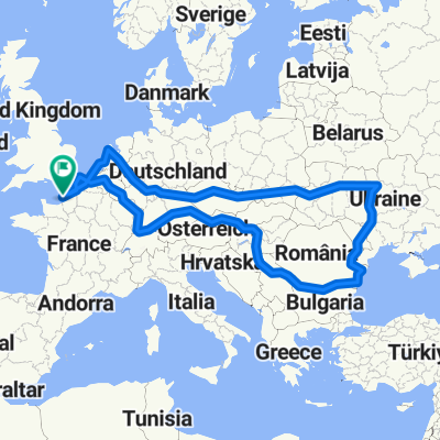 Vue large du parcours
- Distance
- 7,441.9 km
- Ascent
- 2,219 m
- Descent
- 2,219 m
- Location
- Fécamp, Normandy, France
 fecamp ouest
- Distance
- 57.5 km
- Ascent
- 483 m
- Descent
- 483 m
- Location
- Fécamp, Normandy, France
 De Rue du Président René Coty 168, Fécamp à Rue Guy de Maupassant 1, Étretat
- Distance
- 16.2 km
- Ascent
- 352 m
- Descent
- 393 m
- Location
- Fécamp, Normandy, France
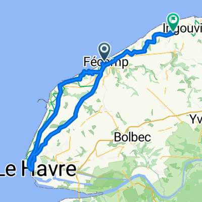
 fecamp honfleur
- Distance
- 77.7 km
- Ascent
- 304 m
- Descent
- 330 m
- Location
- Fécamp, Normandy, France
 26bis Square Maupassant, Fécamp to 1 Place Bigot, Fécamp
- Distance
- 34.5 km
- Ascent
- 0 m
- Descent
- 10 m
- Location
- Fécamp, Normandy, France
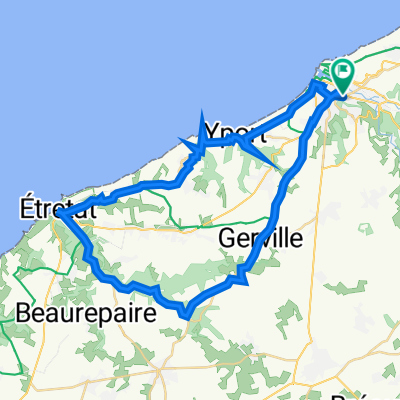 etretat
- Distance
- 41.7 km
- Ascent
- 487 m
- Descent
- 488 m
- Location
- Fécamp, Normandy, France
Open it in the app