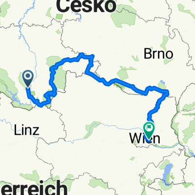
Moldau-Radweg: Krumau - Mühlviertel
A cycling route starting in Český Krumlov, Jihočeský kraj, Czechia.
Overview
About this route
Auf dieser Strecke überquert man Böhmerwald. Längere Anstiege sind unvermeidlich, doch die Stille, die das Plätschern der Bäche und das Rauschen der Bäume hörbar macht, bringt augenblickliche Linderung und Entspannung. Am Schwarzenbergkanal entlang, der einst Brennholztransport für Wien in die Donau ermöglichte, radelt man ins österreichische Mühlviertel.
- -:--
- Duration
- 86.7 km
- Distance
- 1,557 m
- Ascent
- 1,251 m
- Descent
- ---
- Avg. speed
- 902 m
- Max. altitude
Route quality
Waytypes & surfaces along the route
Waytypes
Busy road
37.1 km
(43 %)
Road
18.9 km
(22 %)
Surfaces
Paved
53.9 km
(62 %)
Unpaved
9.9 km
(11 %)
Asphalt
51.2 km
(59 %)
Gravel
9.8 km
(11 %)
Continue with Bikemap
Use, edit, or download this cycling route
You would like to ride Moldau-Radweg: Krumau - Mühlviertel or customize it for your own trip? Here is what you can do with this Bikemap route:
Free features
- Save this route as favorite or in collections
- Copy & plan your own version of this route
- Split it into stages to create a multi-day tour
- Sync your route with Garmin or Wahoo
Premium features
Free trial for 3 days, or one-time payment. More about Bikemap Premium.
- Navigate this route on iOS & Android
- Export a GPX / KML file of this route
- Create your custom printout (try it for free)
- Download this route for offline navigation
Discover more Premium features.
Get Bikemap PremiumFrom our community
Other popular routes starting in Český Krumlov
 ZK - Lipno - V.Brod
- Distance
- 100.8 km
- Ascent
- 912 m
- Descent
- 912 m
- Location
- Český Krumlov, Jihočeský kraj, Czechia
 Sídliště Mír - Kleť - Sídliště Mír
- Distance
- 18 km
- Ascent
- 621 m
- Descent
- 621 m
- Location
- Český Krumlov, Jihočeský kraj, Czechia
 Cesky Krumlov nach Peilstein kurz 53 km
- Distance
- 53.3 km
- Ascent
- 1,129 m
- Descent
- 1,028 m
- Location
- Český Krumlov, Jihočeský kraj, Czechia
 Krumau nach Budweis
- Distance
- 26.4 km
- Ascent
- 207 m
- Descent
- 308 m
- Location
- Český Krumlov, Jihočeský kraj, Czechia
 Český Krumlov, Holasovice Historical Village, Ceske Budejovice
- Distance
- 36.2 km
- Ascent
- 515 m
- Descent
- 677 m
- Location
- Český Krumlov, Jihočeský kraj, Czechia
 Sídliště Mír - Kleť - Sídliště Mír
- Distance
- 18 km
- Ascent
- 608 m
- Descent
- 608 m
- Location
- Český Krumlov, Jihočeský kraj, Czechia
 2- GREENWAY yolu final (krumlov-wien arası )
- Distance
- 456.3 km
- Ascent
- 1,242 m
- Descent
- 1,585 m
- Location
- Český Krumlov, Jihočeský kraj, Czechia
 Južna češka 5. dan lažja
- Distance
- 29.5 km
- Ascent
- 392 m
- Descent
- 393 m
- Location
- Český Krumlov, Jihočeský kraj, Czechia
Open it in the app

