
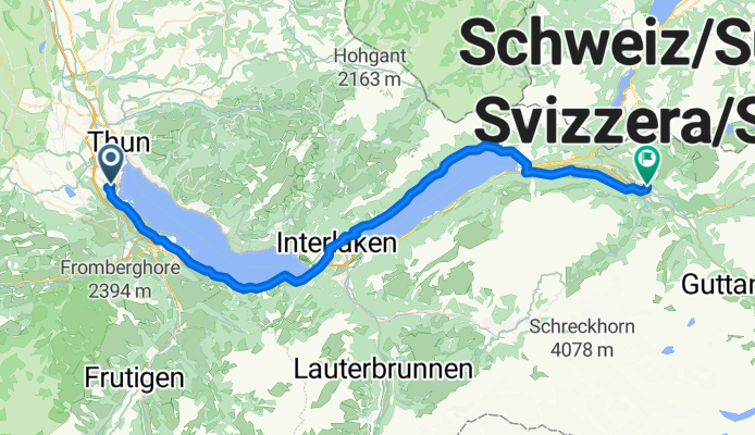
Thun - Meiringen
A cycling route starting in Thun, Canton of Bern, Switzerland.
Overview
About this route
- -:--
- Duration
- 57 km
- Distance
- 286 m
- Ascent
- 253 m
- Descent
- ---
- Avg. speed
- ---
- Avg. speed
Route quality
Waytypes & surfaces along the route
Waytypes
Quiet road
25.7 km
(45 %)
Busy road
18.6 km
(33 %)
Surfaces
Paved
38.5 km
(68 %)
Unpaved
0.4 km
(<1 %)
Asphalt
36.2 km
(63 %)
Paved (undefined)
2.4 km
(4 %)
Continue with Bikemap
Use, edit, or download this cycling route
You would like to ride Thun - Meiringen or customize it for your own trip? Here is what you can do with this Bikemap route:
Free features
- Save this route as favorite or in collections
- Copy & plan your own version of this route
- Sync your route with Garmin or Wahoo
Premium features
Free trial for 3 days, or one-time payment. More about Bikemap Premium.
- Navigate this route on iOS & Android
- Export a GPX / KML file of this route
- Create your custom printout (try it for free)
- Download this route for offline navigation
Discover more Premium features.
Get Bikemap PremiumFrom our community
Other popular routes starting in Thun
 Wimmisrunde
- Distance
- 24.3 km
- Ascent
- 379 m
- Descent
- 382 m
- Location
- Thun, Canton of Bern, Switzerland
 Uebeschi-Runde
- Distance
- 20.7 km
- Ascent
- 186 m
- Descent
- 187 m
- Location
- Thun, Canton of Bern, Switzerland
 Route to Brig
- Distance
- 150 km
- Ascent
- 3,653 m
- Descent
- 3,759 m
- Location
- Thun, Canton of Bern, Switzerland
 Thunersee
- Distance
- 49.8 km
- Ascent
- 222 m
- Descent
- 222 m
- Location
- Thun, Canton of Bern, Switzerland
 CH BE Thun - Saanenmöser
- Distance
- 49 km
- Ascent
- 1,463 m
- Descent
- 756 m
- Location
- Thun, Canton of Bern, Switzerland
 Strecke nach Münsingen über Toffen
- Distance
- 49.2 km
- Ascent
- 366 m
- Descent
- 363 m
- Location
- Thun, Canton of Bern, Switzerland
 Blume
Blume- Distance
- 26.7 km
- Ascent
- 860 m
- Descent
- 857 m
- Location
- Thun, Canton of Bern, Switzerland
 Thunersee-Runde Plus, etliche Fotostopps – und viel Gegenwind
- Distance
- 49.5 km
- Ascent
- 1,123 m
- Descent
- 1,123 m
- Location
- Thun, Canton of Bern, Switzerland
Open it in the app