

St. Gen, Bois St. Eutrope,
A cycling route starting in Sainte-Geneviève-des-Bois, Île-de-France Region, France.
Overview
About this route
- -:--
- Duration
- 27.8 km
- Distance
- 96 m
- Ascent
- 95 m
- Descent
- ---
- Avg. speed
- ---
- Max. altitude

Route quality
Waytypes & surfaces along the route
Waytypes
Quiet road
8.3 km
(30 %)
Track
5.8 km
(21 %)
Surfaces
Paved
10 km
(36 %)
Unpaved
9.5 km
(34 %)
Asphalt
9.7 km
(35 %)
Gravel
7.8 km
(28 %)
Continue with Bikemap
Use, edit, or download this cycling route
You would like to ride St. Gen, Bois St. Eutrope, or customize it for your own trip? Here is what you can do with this Bikemap route:
Free features
- Save this route as favorite or in collections
- Copy & plan your own version of this route
- Sync your route with Garmin or Wahoo
Premium features
Free trial for 3 days, or one-time payment. More about Bikemap Premium.
- Navigate this route on iOS & Android
- Export a GPX / KML file of this route
- Create your custom printout (try it for free)
- Download this route for offline navigation
Discover more Premium features.
Get Bikemap PremiumFrom our community
Other popular routes starting in Sainte-Geneviève-des-Bois
 60 Rue du Général de Gaulle, Sainte-Geneviève-des-Bois à 52 Avenue Georges Pitard, Sainte-Geneviève-des-Bois
- Distance
- 33.7 km
- Ascent
- 495 m
- Descent
- 495 m
- Location
- Sainte-Geneviève-des-Bois, Île-de-France Region, France
 De 22 Rue du Midi, Sainte-Geneviève-des-Bois à 29 Rue du Midi, Sainte-Geneviève-des-Bois
- Distance
- 31.4 km
- Ascent
- 583 m
- Descent
- 583 m
- Location
- Sainte-Geneviève-des-Bois, Île-de-France Region, France
 with Stephane
- Distance
- 39.6 km
- Ascent
- 315 m
- Descent
- 286 m
- Location
- Sainte-Geneviève-des-Bois, Île-de-France Region, France
 St. Gen, Bretigny, Bondoufle, Fleury facile
- Distance
- 29.6 km
- Ascent
- 43 m
- Descent
- 42 m
- Location
- Sainte-Geneviève-des-Bois, Île-de-France Region, France
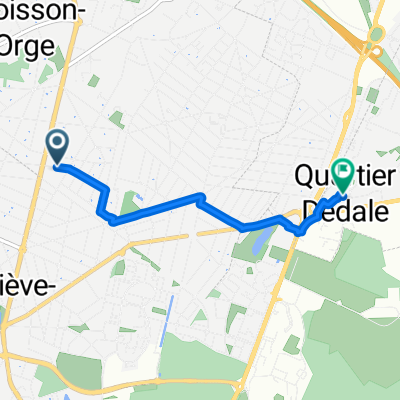 Rue de Corbeil, Morsang-sur-Orge à Rue Dédale, Grigny
- Distance
- 3.6 km
- Ascent
- 3 m
- Descent
- 0 m
- Location
- Sainte-Geneviève-des-Bois, Île-de-France Region, France
 SGDB to Paris
- Distance
- 31.2 km
- Ascent
- 173 m
- Descent
- 215 m
- Location
- Sainte-Geneviève-des-Bois, Île-de-France Region, France
 10 Rue Jeanne d'Arc, Sainte-Geneviève-des-Bois à 6 Chemin de Gournay, Le Plessis-Trévise
- Distance
- 35 km
- Ascent
- 157 m
- Descent
- 121 m
- Location
- Sainte-Geneviève-des-Bois, Île-de-France Region, France
 De Route de Corbeil 12, Sainte-Geneviève-des-Bois à Rue des Tulipes 14, Villiers-sur-Orge
- Distance
- 7.1 km
- Ascent
- 68 m
- Descent
- 122 m
- Location
- Sainte-Geneviève-des-Bois, Île-de-France Region, France
Open it in the app