

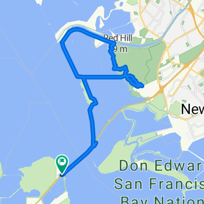
Baytrail project West lower
A cycling route starting in East Palo Alto, California, United States.
Overview
About this route
- -:--
- Duration
- 50 km
- Distance
- 5 m
- Ascent
- 7 m
- Descent
- ---
- Avg. speed
- ---
- Max. altitude

Route quality
Waytypes & surfaces along the route
Waytypes
Cycleway
26 km
(52 %)
Road
10 km
(20 %)
Surfaces
Paved
29 km
(58 %)
Unpaved
6 km
(12 %)
Asphalt
17 km
(34 %)
Concrete
9.5 km
(19 %)
Continue with Bikemap
Use, edit, or download this cycling route
You would like to ride Baytrail project West lower or customize it for your own trip? Here is what you can do with this Bikemap route:
Free features
- Save this route as favorite or in collections
- Copy & plan your own version of this route
- Sync your route with Garmin or Wahoo
Premium features
Free trial for 3 days, or one-time payment. More about Bikemap Premium.
- Navigate this route on iOS & Android
- Export a GPX / KML file of this route
- Create your custom printout (try it for free)
- Download this route for offline navigation
Discover more Premium features.
Get Bikemap PremiumFrom our community
Other popular routes starting in East Palo Alto
 Big Loop Arastradero + Portola Valley + Palo Alto
- Distance
- 37 km
- Ascent
- 297 m
- Descent
- 297 m
- Location
- East Palo Alto, California, United States
 kings mountain
- Distance
- 45.1 km
- Ascent
- 898 m
- Descent
- 888 m
- Location
- East Palo Alto, California, United States
 Dumbarton to Coyote Hills Loop
- Distance
- 27.7 km
- Ascent
- 81 m
- Descent
- 81 m
- Location
- East Palo Alto, California, United States
 8/26/2017 Newark-Facebook
- Distance
- 25.2 km
- Ascent
- 19 m
- Descent
- 13 m
- Location
- East Palo Alto, California, United States
 De Baylor Street 2529, East Palo Alto a Baylor Street 2536, East Palo Alto
- Distance
- 35.3 km
- Ascent
- 16 m
- Descent
- 20 m
- Location
- East Palo Alto, California, United States
 Dumbarton Loop
- Distance
- 29.7 km
- Ascent
- 41 m
- Descent
- 43 m
- Location
- East Palo Alto, California, United States
 Baytrail project West lower
- Distance
- 50 km
- Ascent
- 5 m
- Descent
- 7 m
- Location
- East Palo Alto, California, United States
 East Palo Alto to Sunnyvale Office
- Distance
- 15.9 km
- Ascent
- 0 m
- Descent
- 0 m
- Location
- East Palo Alto, California, United States
Open it in the app