

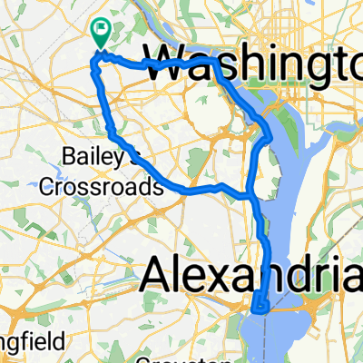
Saturday DC think ride?
A cycling route starting in Arlington, Virginia, United States.
Overview
About this route
- -:--
- Duration
- 26.9 km
- Distance
- 170 m
- Ascent
- 169 m
- Descent
- ---
- Avg. speed
- ---
- Max. altitude

Route quality
Waytypes & surfaces along the route
Waytypes
Cycleway
16.7 km
(62 %)
Quiet road
4.6 km
(17 %)
Surfaces
Paved
25.3 km
(94 %)
Unpaved
1.1 km
(4 %)
Asphalt
19.1 km
(71 %)
Paved (undefined)
3 km
(11 %)
Continue with Bikemap
Use, edit, or download this cycling route
You would like to ride Saturday DC think ride? or customize it for your own trip? Here is what you can do with this Bikemap route:
Free features
- Save this route as favorite or in collections
- Copy & plan your own version of this route
- Sync your route with Garmin or Wahoo
Premium features
Free trial for 3 days, or one-time payment. More about Bikemap Premium.
- Navigate this route on iOS & Android
- Export a GPX / KML file of this route
- Create your custom printout (try it for free)
- Download this route for offline navigation
Discover more Premium features.
Get Bikemap PremiumFrom our community
Other popular routes starting in Arlington
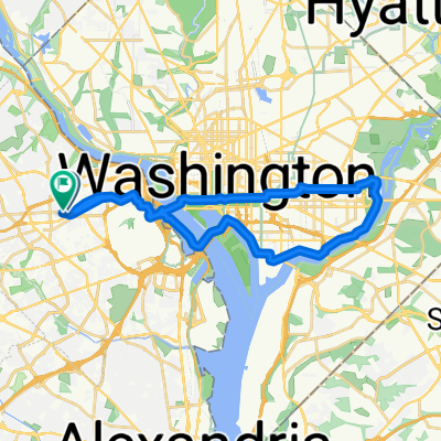
 Old Town
- Distance
- 40.3 km
- Ascent
- 199 m
- Descent
- 199 m
- Location
- Arlington, Virginia, United States
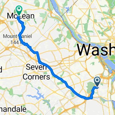
 Lorcom Ln, Arlington to Old Mill Rd, Alexandria
- Distance
- 35.7 km
- Ascent
- 226 m
- Descent
- 307 m
- Location
- Arlington, Virginia, United States
 Saturday DC think ride?
- Distance
- 26.9 km
- Ascent
- 170 m
- Descent
- 169 m
- Location
- Arlington, Virginia, United States
 Cafe Levantine
- Distance
- 19.5 km
- Ascent
- 214 m
- Descent
- 164 m
- Location
- Arlington, Virginia, United States
 38.886, -77.101 to 38.886, -77.102
- Distance
- 31 km
- Ascent
- 274 m
- Descent
- 276 m
- Location
- Arlington, Virginia, United States
 Rosslyn to BEP
- Distance
- 6.6 km
- Ascent
- 17 m
- Descent
- 56 m
- Location
- Arlington, Virginia, United States
 38.886, -77.102 to 38.886, -77.102
- Distance
- 30.3 km
- Ascent
- 266 m
- Descent
- 271 m
- Location
- Arlington, Virginia, United States
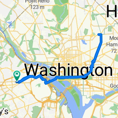
 Epic Sligo/Anacostia/SilverSpring/RockCreek 62.4
- Distance
- 62.4 km
- Ascent
- 215 m
- Descent
- 209 m
- Location
- Arlington, Virginia, United States
Open it in the app