
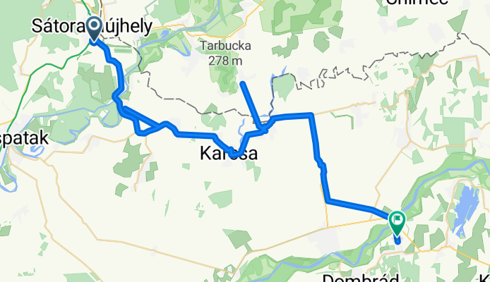
Sátoraljaújhely to Fő utca 117, Tiszakanyár
A cycling route starting in Sátoraljaújhely, Borsod-Abauj Zemplen county, Hungary.
Overview
About this route
- 4 h 27 min
- Duration
- 60.1 km
- Distance
- 243 m
- Ascent
- 294 m
- Descent
- 13.5 km/h
- Avg. speed
- ---
- Max. altitude

Route photos


Continue with Bikemap
Use, edit, or download this cycling route
You would like to ride Sátoraljaújhely to Fő utca 117, Tiszakanyár or customize it for your own trip? Here is what you can do with this Bikemap route:
Free features
- Save this route as favorite or in collections
- Copy & plan your own version of this route
- Sync your route with Garmin or Wahoo
Premium features
Free trial for 3 days, or one-time payment. More about Bikemap Premium.
- Navigate this route on iOS & Android
- Export a GPX / KML file of this route
- Create your custom printout (try it for free)
- Download this route for offline navigation
Discover more Premium features.
Get Bikemap PremiumFrom our community
Other popular routes starting in Sátoraljaújhely
 STEREO KIPRÓBÁLVA 2023
- Distance
- 40.8 km
- Ascent
- 892 m
- Descent
- 893 m
- Location
- Sátoraljaújhely, Borsod-Abauj Zemplen county, Hungary
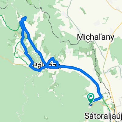
 Pálháza_Kéked_Pálháza
- Distance
- 57.4 km
- Ascent
- 818 m
- Descent
- 820 m
- Location
- Sátoraljaújhely, Borsod-Abauj Zemplen county, Hungary
 XPF Szép út :)
- Distance
- 50.2 km
- Ascent
- 699 m
- Descent
- 701 m
- Location
- Sátoraljaújhely, Borsod-Abauj Zemplen county, Hungary
 Kis hegyköz kör
- Distance
- 23 km
- Ascent
- 228 m
- Descent
- 228 m
- Location
- Sátoraljaújhely, Borsod-Abauj Zemplen county, Hungary
 STEREO_Pálháza Szalánc vára
- Distance
- 27.1 km
- Ascent
- 744 m
- Descent
- 469 m
- Location
- Sátoraljaújhely, Borsod-Abauj Zemplen county, Hungary
 Kárpát utca - Kárpát utca
- Distance
- 56.7 km
- Ascent
- 782 m
- Descent
- 783 m
- Location
- Sátoraljaújhely, Borsod-Abauj Zemplen county, Hungary
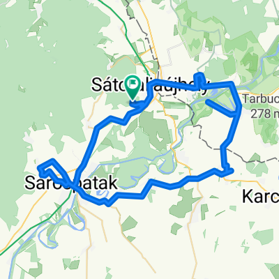 Zemplén 3.1
- Distance
- 65.4 km
- Ascent
- 279 m
- Descent
- 282 m
- Location
- Sátoraljaújhely, Borsod-Abauj Zemplen county, Hungary
 Sátoraljaújhely to Fő utca 117, Tiszakanyár
- Distance
- 60.1 km
- Ascent
- 243 m
- Descent
- 294 m
- Location
- Sátoraljaújhely, Borsod-Abauj Zemplen county, Hungary
Open it in the app