

30.05.2020
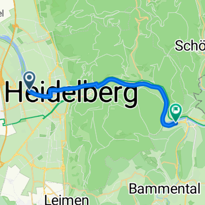
A cycling route starting in Eppelheim, Baden-Wurttemberg, Germany.
Overview
About this route
- 3 h 32 min
- Duration
- 43.9 km
- Distance
- 507 m
- Ascent
- 507 m
- Descent
- 12.4 km/h
- Avg. speed
- ---
- Max. altitude

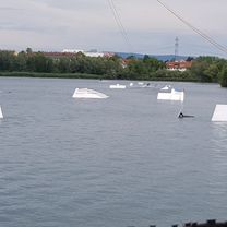
Route photos


Route quality
Waytypes & surfaces along the route
Waytypes
Track
15.8 km
(36 %)
Quiet road
9.7 km
(22 %)
Surfaces
Paved
29.4 km
(67 %)
Unpaved
13.2 km
(30 %)
Asphalt
28.6 km
(65 %)
Gravel
12.3 km
(28 %)
Route highlights
Points of interest along the route

Point of interest after 19.8 km

Point of interest after 23.5 km

Point of interest after 25.9 km

Point of interest after 27.6 km

Point of interest after 28.3 km
Continue with Bikemap
Use, edit, or download this cycling route
You would like to ride 30.05.2020 or customize it for your own trip? Here is what you can do with this Bikemap route:
Free features
- Save this route as favorite or in collections
- Copy & plan your own version of this route
- Sync your route with Garmin or Wahoo
Premium features
Free trial for 3 days, or one-time payment. More about Bikemap Premium.
- Navigate this route on iOS & Android
- Export a GPX / KML file of this route
- Create your custom printout (try it for free)
- Download this route for offline navigation
Discover more Premium features.
Get Bikemap PremiumFrom our community
Other popular routes starting in Eppelheim
 Rennrad Feierabend-Runde
- Distance
- 45.9 km
- Ascent
- 322 m
- Descent
- 319 m
- Location
- Eppelheim, Baden-Wurttemberg, Germany
 Tour de Heidelberg
- Distance
- 61 km
- Ascent
- 1,416 m
- Descent
- 1,419 m
- Location
- Eppelheim, Baden-Wurttemberg, Germany
 RTF HD 90
- Distance
- 92.2 km
- Ascent
- 1,786 m
- Descent
- 1,784 m
- Location
- Eppelheim, Baden-Wurttemberg, Germany
 100 km Rheinebene
- Distance
- 108.8 km
- Ascent
- 96 m
- Descent
- 95 m
- Location
- Eppelheim, Baden-Wurttemberg, Germany
 pe - Heidelberg - Eppelheim - Gauangelloch Rundweg
- Distance
- 52.2 km
- Ascent
- 309 m
- Descent
- 309 m
- Location
- Eppelheim, Baden-Wurttemberg, Germany
 Wieslocher Sonntagsrunde
- Distance
- 38.3 km
- Ascent
- 244 m
- Descent
- 230 m
- Location
- Eppelheim, Baden-Wurttemberg, Germany
 Mannheimer Straße nach Bahnhofstraße
- Distance
- 14.2 km
- Ascent
- 31 m
- Descent
- 69 m
- Location
- Eppelheim, Baden-Wurttemberg, Germany
 Tour HD -> MA Rheinau
- Distance
- 15.8 km
- Ascent
- 32 m
- Descent
- 33 m
- Location
- Eppelheim, Baden-Wurttemberg, Germany
Open it in the app