

JUb4_LeLocle_Travers
A cycling route starting in Le Locle, Canton of Neuchâtel, Switzerland.
Overview
About this route
La Coue, zw Travers und Couvet, südlich der Hauptstr
Fleurier, Camping du Val de Travers
- -:--
- Duration
- 37.4 km
- Distance
- 463 m
- Ascent
- 744 m
- Descent
- ---
- Avg. speed
- ---
- Max. altitude
Route quality
Waytypes & surfaces along the route
Waytypes
Quiet road
16.5 km
(44 %)
Road
7.5 km
(20 %)
Surfaces
Paved
16.5 km
(44 %)
Asphalt
16.1 km
(43 %)
Paved (undefined)
0.4 km
(1 %)
Undefined
21 km
(56 %)
Continue with Bikemap
Use, edit, or download this cycling route
You would like to ride JUb4_LeLocle_Travers or customize it for your own trip? Here is what you can do with this Bikemap route:
Free features
- Save this route as favorite or in collections
- Copy & plan your own version of this route
- Sync your route with Garmin or Wahoo
Premium features
Free trial for 3 days, or one-time payment. More about Bikemap Premium.
- Navigate this route on iOS & Android
- Export a GPX / KML file of this route
- Create your custom printout (try it for free)
- Download this route for offline navigation
Discover more Premium features.
Get Bikemap PremiumFrom our community
Other popular routes starting in Le Locle
 LeLocle-St.Ursanne
- Distance
- 73.4 km
- Ascent
- 716 m
- Descent
- 1,220 m
- Location
- Le Locle, Canton of Neuchâtel, Switzerland
 Le Locle-Les Verrieres-Motiers
- Distance
- 57.1 km
- Ascent
- 864 m
- Descent
- 1,052 m
- Location
- Le Locle, Canton of Neuchâtel, Switzerland
 JUb4_LeLocle_Travers
- Distance
- 37.4 km
- Ascent
- 463 m
- Descent
- 744 m
- Location
- Le Locle, Canton of Neuchâtel, Switzerland
 Le Locle - Doubs - Le Locle Camping
- Distance
- 32.8 km
- Ascent
- 938 m
- Descent
- 935 m
- Location
- Le Locle, Canton of Neuchâtel, Switzerland
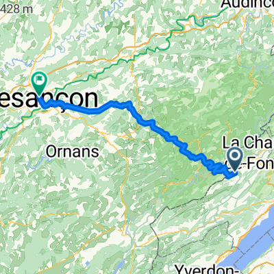 LeLocle Besancon
- Distance
- 89.1 km
- Ascent
- 643 m
- Descent
- 1,310 m
- Location
- Le Locle, Canton of Neuchâtel, Switzerland
 Rue du Midi 11, Le Locle nach Tunnel du Mont Sagne, La Chaux-de-Fonds
- Distance
- 43.7 km
- Ascent
- 885 m
- Descent
- 942 m
- Location
- Le Locle, Canton of Neuchâtel, Switzerland
 nach Pontarlier
- Distance
- 66 km
- Ascent
- 1,314 m
- Descent
- 1,358 m
- Location
- Le Locle, Canton of Neuchâtel, Switzerland
 Le Locle_Châtillon
- Distance
- 51.4 km
- Ascent
- 689 m
- Descent
- 941 m
- Location
- Le Locle, Canton of Neuchâtel, Switzerland
Open it in the app