

coast run
A cycling route starting in Chard, England, United Kingdom.
Overview
About this route
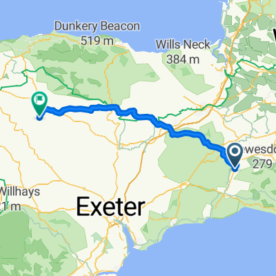
chard westbay lyme seaton honiton smeatharpe combe chard
- -:--
- Duration
- 117.9 km
- Distance
- 1,213 m
- Ascent
- 1,213 m
- Descent
- ---
- Avg. speed
- ---
- Max. altitude
Route quality
Waytypes & surfaces along the route
Waytypes
Quiet road
64.9 km
(55 %)
Road
21.2 km
(18 %)
Surfaces
Paved
41.3 km
(35 %)
Asphalt
36.6 km
(31 %)
Paved (undefined)
4.7 km
(4 %)
Undefined
76.7 km
(65 %)
Continue with Bikemap
Use, edit, or download this cycling route
You would like to ride coast run or customize it for your own trip? Here is what you can do with this Bikemap route:
Free features
- Save this route as favorite or in collections
- Copy & plan your own version of this route
- Split it into stages to create a multi-day tour
- Sync your route with Garmin or Wahoo
Premium features
Free trial for 3 days, or one-time payment. More about Bikemap Premium.
- Navigate this route on iOS & Android
- Export a GPX / KML file of this route
- Create your custom printout (try it for free)
- Download this route for offline navigation
Discover more Premium features.
Get Bikemap PremiumFrom our community
Other popular routes starting in Chard
 From Axminster to Colyton
- Distance
- 18 km
- Ascent
- 152 m
- Descent
- 254 m
- Location
- Chard, England, United Kingdom
 Chardstock Com Hall to Broad Windsor
- Distance
- 47.4 km
- Ascent
- 820 m
- Descent
- 817 m
- Location
- Chard, England, United Kingdom
 South Somerset route
- Distance
- 125 km
- Ascent
- 509 m
- Descent
- 509 m
- Location
- Chard, England, United Kingdom
 coast run
- Distance
- 117.9 km
- Ascent
- 1,213 m
- Descent
- 1,213 m
- Location
- Chard, England, United Kingdom
 Chard to Stoke St Mary
- Distance
- 36.1 km
- Ascent
- 309 m
- Descent
- 403 m
- Location
- Chard, England, United Kingdom
 Route from Balsom Close, Chard
- Distance
- 11.5 km
- Ascent
- 0 m
- Descent
- 11 m
- Location
- Chard, England, United Kingdom
 Chard back
- Distance
- 45.3 km
- Ascent
- 329 m
- Descent
- 429 m
- Location
- Chard, England, United Kingdom
 Chard to George Nympton
- Distance
- 84.5 km
- Ascent
- 1,239 m
- Descent
- 1,249 m
- Location
- Chard, England, United Kingdom
Open it in the app