

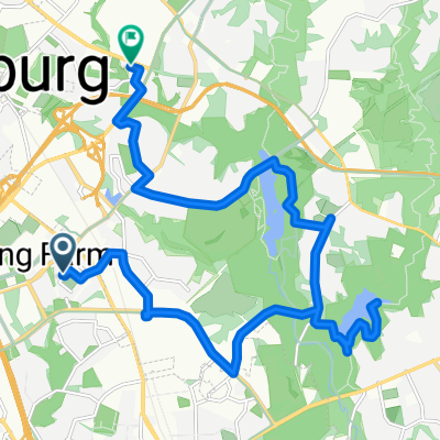
Rock Creek Trail North
A cycling route starting in Derwood, Maryland, United States.
Overview
About this route
Upper Rock Creek Trail between Needwood Lake and Capital Crescent Trail.
Caution road bikes, there are frequent potholes, foliage and mud patches.
- -:--
- Duration
- 20.2 km
- Distance
- 103 m
- Ascent
- 157 m
- Descent
- ---
- Avg. speed
- ---
- Max. altitude

Route quality
Waytypes & surfaces along the route
Waytypes
Cycleway
17.8 km
(88 %)
Road
1.2 km
(6 %)
Surfaces
Paved
19.8 km
(98 %)
Unpaved
0.2 km
(1 %)
Asphalt
19 km
(94 %)
Concrete
0.6 km
(3 %)
Continue with Bikemap
Use, edit, or download this cycling route
You would like to ride Rock Creek Trail North or customize it for your own trip? Here is what you can do with this Bikemap route:
Free features
- Save this route as favorite or in collections
- Copy & plan your own version of this route
- Sync your route with Garmin or Wahoo
Premium features
Free trial for 3 days, or one-time payment. More about Bikemap Premium.
- Navigate this route on iOS & Android
- Export a GPX / KML file of this route
- Create your custom printout (try it for free)
- Download this route for offline navigation
Discover more Premium features.
Get Bikemap PremiumFrom our community
Other popular routes starting in Derwood
 Pleasant Dr, Rockville to Vestry Ct, Derwood
- Distance
- 20.8 km
- Ascent
- 235 m
- Descent
- 239 m
- Location
- Derwood, Maryland, United States
 455 Elmcroft Blvd, Rockville to 455 Elmcroft Blvd, Rockville
- Distance
- 6.7 km
- Ascent
- 47 m
- Descent
- 46 m
- Location
- Derwood, Maryland, United States
 Needwood Loop
- Distance
- 33.7 km
- Ascent
- 226 m
- Descent
- 225 m
- Location
- Derwood, Maryland, United States
 Lake Needwood to True Respite Brewing
- Distance
- 2.6 km
- Ascent
- 63 m
- Descent
- 40 m
- Location
- Derwood, Maryland, United States
 Rock Creek
- Distance
- 20.8 km
- Ascent
- 162 m
- Descent
- 143 m
- Location
- Derwood, Maryland, United States
 Ride 1 november
- Distance
- 82 km
- Ascent
- 754 m
- Descent
- 754 m
- Location
- Derwood, Maryland, United States
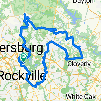
 Brighton Dam Loop
- Distance
- 76.6 km
- Ascent
- 306 m
- Descent
- 305 m
- Location
- Derwood, Maryland, United States
 Travilah-Kentlands
- Distance
- 17 km
- Ascent
- 86 m
- Descent
- 115 m
- Location
- Derwood, Maryland, United States
Open it in the app