

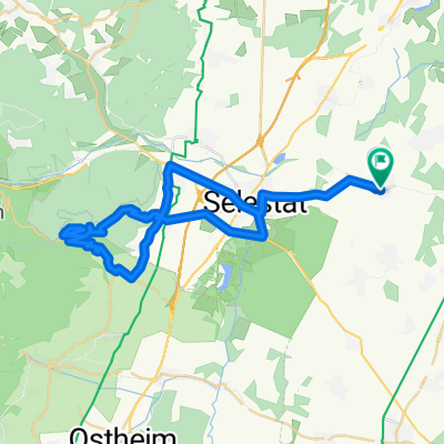
Sortie du jeudi 29 Juillet 2010
A cycling route starting in Muttersholtz, Alsace-Champagne-Ardenne-Lorraine, France.
Overview
About this route
- -:--
- Duration
- 81.2 km
- Distance
- 1,029 m
- Ascent
- 1,028 m
- Descent
- ---
- Avg. speed
- ---
- Max. altitude
Route quality
Waytypes & surfaces along the route
Waytypes
Busy road
36.6 km
(45 %)
Road
29.2 km
(36 %)
Surfaces
Paved
32.3 km
(40 %)
Unpaved
0.8 km
(<1 %)
Asphalt
31 km
(38 %)
Paved (undefined)
1 km
(1 %)
Continue with Bikemap
Use, edit, or download this cycling route
You would like to ride Sortie du jeudi 29 Juillet 2010 or customize it for your own trip? Here is what you can do with this Bikemap route:
Free features
- Save this route as favorite or in collections
- Copy & plan your own version of this route
- Split it into stages to create a multi-day tour
- Sync your route with Garmin or Wahoo
Premium features
Free trial for 3 days, or one-time payment. More about Bikemap Premium.
- Navigate this route on iOS & Android
- Export a GPX / KML file of this route
- Create your custom printout (try it for free)
- Download this route for offline navigation
Discover more Premium features.
Get Bikemap PremiumFrom our community
Other popular routes starting in Muttersholtz
 Els1: Ehnwihr-Colmar 77km 159hm
- Distance
- 77 km
- Ascent
- 159 m
- Descent
- 161 m
- Location
- Muttersholtz, Alsace-Champagne-Ardenne-Lorraine, France
 Sortie du 3 Aout 2010 avec Eric Lorrain
- Distance
- 193.1 km
- Ascent
- 1,672 m
- Descent
- 1,663 m
- Location
- Muttersholtz, Alsace-Champagne-Ardenne-Lorraine, France
 Sortie du 13 Jiu
- Distance
- 47.6 km
- Ascent
- 573 m
- Descent
- 574 m
- Location
- Muttersholtz, Alsace-Champagne-Ardenne-Lorraine, France
 Els5: Ehnwihr-DambachLaVille-Ribeauville-Guemar-SchlettstadterFeld-Sundhouse-Ehnwihr 69,1km 233hm
- Distance
- 77.4 km
- Ascent
- 246 m
- Descent
- 248 m
- Location
- Muttersholtz, Alsace-Champagne-Ardenne-Lorraine, France
 Els4: Ehnwihr-Selestat Bhf 7,5km 22hm
- Distance
- 7.5 km
- Ascent
- 22 m
- Descent
- 14 m
- Location
- Muttersholtz, Alsace-Champagne-Ardenne-Lorraine, France
 Muttersholtz-Canal-Rhin-Canal-Muttersholtz
- Distance
- 60.2 km
- Ascent
- 40 m
- Descent
- 44 m
- Location
- Muttersholtz, Alsace-Champagne-Ardenne-Lorraine, France
 Sortie du jeudi 29 Juillet 2010
- Distance
- 81.2 km
- Ascent
- 1,029 m
- Descent
- 1,028 m
- Location
- Muttersholtz, Alsace-Champagne-Ardenne-Lorraine, France
 Test GPS 27 Juillet 2015
- Distance
- 21.5 km
- Ascent
- 18 m
- Descent
- 19 m
- Location
- Muttersholtz, Alsace-Champagne-Ardenne-Lorraine, France
Open it in the app