

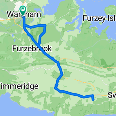
Unnamed Road to Turbary Park Avenue 176K
A cycling route starting in Wareham, England, United Kingdom.
Overview
About this route
- 3 h 54 min
- Duration
- 31.4 km
- Distance
- 271 m
- Ascent
- 253 m
- Descent
- 8.1 km/h
- Avg. speed
- ---
- Max. altitude

Route photos


Continue with Bikemap
Use, edit, or download this cycling route
You would like to ride Unnamed Road to Turbary Park Avenue 176K or customize it for your own trip? Here is what you can do with this Bikemap route:
Free features
- Save this route as favorite or in collections
- Copy & plan your own version of this route
- Sync your route with Garmin or Wahoo
Premium features
Free trial for 3 days, or one-time payment. More about Bikemap Premium.
- Navigate this route on iOS & Android
- Export a GPX / KML file of this route
- Create your custom printout (try it for free)
- Download this route for offline navigation
Discover more Premium features.
Get Bikemap PremiumFrom our community
Other popular routes starting in Wareham
 Filieul Toad
- Distance
- 13.3 km
- Ascent
- 75 m
- Descent
- 74 m
- Location
- Wareham, England, United Kingdom
 ride through Wareham
- Distance
- 15.6 km
- Ascent
- 120 m
- Descent
- 118 m
- Location
- Wareham, England, United Kingdom
 Kimmeridge roure
- Distance
- 24.6 km
- Ascent
- 300 m
- Descent
- 304 m
- Location
- Wareham, England, United Kingdom
 Lengthy bike tour through Wareham
- Distance
- 31.3 km
- Ascent
- 258 m
- Descent
- 258 m
- Location
- Wareham, England, United Kingdom
 Unnamed Road to Turbary Park Avenue 176K
- Distance
- 31.4 km
- Ascent
- 271 m
- Descent
- 253 m
- Location
- Wareham, England, United Kingdom
 jurassic
- Distance
- 23.4 km
- Ascent
- 363 m
- Descent
- 342 m
- Location
- Wareham, England, United Kingdom
 Creech Hill and Heaths
- Distance
- 23.3 km
- Ascent
- 228 m
- Descent
- 228 m
- Location
- Wareham, England, United Kingdom
 Purbeck Si Jim
- Distance
- 77 km
- Ascent
- 539 m
- Descent
- 530 m
- Location
- Wareham, England, United Kingdom
Open it in the app