
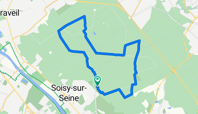
Boucle en forêt de Sénart - 1995 - UtagawaVTT.com
A cycling route starting in Soisy-sur-Seine, Île-de-France Region, France.
Overview
About this route
- 1 h 18 min
- Duration
- 14.9 km
- Distance
- 7 m
- Ascent
- 6 m
- Descent
- 11.4 km/h
- Avg. speed
- ---
- Max. altitude
Route quality
Waytypes & surfaces along the route
Waytypes
Track
7.1 km
(48 %)
Path
6.3 km
(42 %)
Surfaces
Paved
1.3 km
(9 %)
Unpaved
13.4 km
(90 %)
Sand
5.3 km
(35 %)
Ground
3.4 km
(23 %)
Continue with Bikemap
Use, edit, or download this cycling route
You would like to ride Boucle en forêt de Sénart - 1995 - UtagawaVTT.com or customize it for your own trip? Here is what you can do with this Bikemap route:
Free features
- Save this route as favorite or in collections
- Copy & plan your own version of this route
- Sync your route with Garmin or Wahoo
Premium features
Free trial for 3 days, or one-time payment. More about Bikemap Premium.
- Navigate this route on iOS & Android
- Export a GPX / KML file of this route
- Create your custom printout (try it for free)
- Download this route for offline navigation
Discover more Premium features.
Get Bikemap PremiumFrom our community
Other popular routes starting in Soisy-sur-Seine
 De Route Forestière de Maupertuis, Étiolles à Rue des Mimosas 6, Paray-Vieille-Poste
- Distance
- 15.5 km
- Ascent
- 88 m
- Descent
- 91 m
- Location
- Soisy-sur-Seine, Île-de-France Region, France
 Recovered Route
- Distance
- 6.3 km
- Ascent
- 61 m
- Descent
- 68 m
- Location
- Soisy-sur-Seine, Île-de-France Region, France
 De Chemin de Brunoy, Soisy-sur-Seine à 17 Allée Beauséjour, Villeneuve-Saint-Georges
- Distance
- 11.8 km
- Ascent
- 83 m
- Descent
- 90 m
- Location
- Soisy-sur-Seine, Île-de-France Region, France
 raccourci pour des champignons
- Distance
- 5 km
- Ascent
- 98 m
- Descent
- 95 m
- Location
- Soisy-sur-Seine, Île-de-France Region, France
 De Rue des Champs Talloup 2, Soisy-sur-Seine à Chemin des Plâtrières 1515, Aix-en-Provence
- Distance
- 700.1 km
- Ascent
- 5,518 m
- Descent
- 5,285 m
- Location
- Soisy-sur-Seine, Île-de-France Region, France
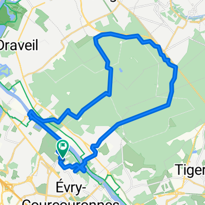 Single track Sénart - Évry
- Distance
- 25.5 km
- Ascent
- 176 m
- Descent
- 174 m
- Location
- Soisy-sur-Seine, Île-de-France Region, France
 Easy ride in Soisy-sur-Seine
- Distance
- 14.1 km
- Ascent
- 10 m
- Descent
- 9 m
- Location
- Soisy-sur-Seine, Île-de-France Region, France
 11 Chemin du Bac de Ris, Soisy-sur-Seine à 14 Avenue Granger, Draveil
- Distance
- 4.6 km
- Ascent
- 32 m
- Descent
- 15 m
- Location
- Soisy-sur-Seine, Île-de-France Region, France
Open it in the app