

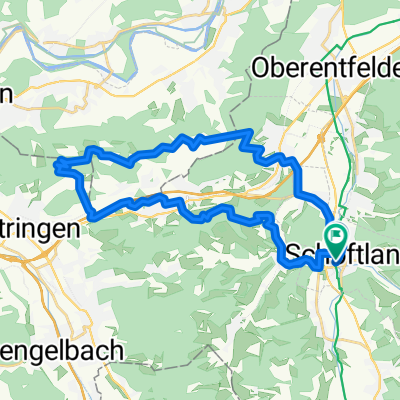
Schöftland-Mühlethal-Wiliberg-Rehhag-Böhler
A cycling route starting in Schöftland, Canton of Aargau, Switzerland.
Overview
About this route
- -:--
- Duration
- 65.8 km
- Distance
- 1,072 m
- Ascent
- 1,019 m
- Descent
- ---
- Avg. speed
- 779 m
- Max. altitude
Route quality
Waytypes & surfaces along the route
Waytypes
Road
39.5 km
(60 %)
Quiet road
10.5 km
(16 %)
Surfaces
Paved
30.9 km
(47 %)
Asphalt
28.3 km
(43 %)
Paved (undefined)
1.3 km
(2 %)
Continue with Bikemap
Use, edit, or download this cycling route
You would like to ride Schöftland-Mühlethal-Wiliberg-Rehhag-Böhler or customize it for your own trip? Here is what you can do with this Bikemap route:
Free features
- Save this route as favorite or in collections
- Copy & plan your own version of this route
- Sync your route with Garmin or Wahoo
Premium features
Free trial for 3 days, or one-time payment. More about Bikemap Premium.
- Navigate this route on iOS & Android
- Export a GPX / KML file of this route
- Create your custom printout (try it for free)
- Download this route for offline navigation
Discover more Premium features.
Get Bikemap PremiumFrom our community
Other popular routes starting in Schöftland
 Route in Schöftland
- Distance
- 31 km
- Ascent
- 864 m
- Descent
- 864 m
- Location
- Schöftland, Canton of Aargau, Switzerland
 Schöftland-Bern-Düdingen
- Distance
- 116.4 km
- Ascent
- 960 m
- Descent
- 875 m
- Location
- Schöftland, Canton of Aargau, Switzerland
 Schöftland-Lueg-Schöftland
- Distance
- 107.1 km
- Ascent
- 1,000 m
- Descent
- 968 m
- Location
- Schöftland, Canton of Aargau, Switzerland
 Schöftland-Düdingen
- Distance
- 117.9 km
- Ascent
- 861 m
- Descent
- 776 m
- Location
- Schöftland, Canton of Aargau, Switzerland
 nach Sion
- Distance
- 269.1 km
- Ascent
- 2,756 m
- Descent
- 2,723 m
- Location
- Schöftland, Canton of Aargau, Switzerland
 Schöftland-Mühlethal-Wiliberg-Rehhag-Böhler
- Distance
- 65.8 km
- Ascent
- 1,072 m
- Descent
- 1,019 m
- Location
- Schöftland, Canton of Aargau, Switzerland
 AG Schöftland - Sattelegg - Schöftland
- Distance
- 65.3 km
- Ascent
- 613 m
- Descent
- 613 m
- Location
- Schöftland, Canton of Aargau, Switzerland
 Grenzen erfahren Töffli
- Distance
- 72.4 km
- Ascent
- 769 m
- Descent
- 775 m
- Location
- Schöftland, Canton of Aargau, Switzerland
Open it in the app