

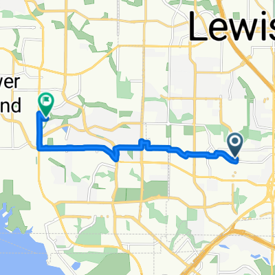
Lewisville to Denton
A cycling route starting in Lewisville, Texas, United States of America.
Overview
About this route
- 2 h 38 min
- Duration
- 64.1 km
- Distance
- 207 m
- Ascent
- 206 m
- Descent
- 24.4 km/h
- Avg. speed
- ---
- Max. altitude

Route quality
Waytypes & surfaces along the route
Waytypes
Cycleway
44 km
(69 %)
Busy road
6.8 km
(11 %)
Surfaces
Paved
46.1 km
(72 %)
Concrete
45.7 km
(71 %)
Paved (undefined)
0.4 km
(<1 %)
Undefined
18 km
(28 %)
Continue with Bikemap
Use, edit, or download this cycling route
You would like to ride Lewisville to Denton or customize it for your own trip? Here is what you can do with this Bikemap route:
Free features
- Save this route as favorite or in collections
- Copy & plan your own version of this route
- Sync your route with Garmin or Wahoo
Premium features
Free trial for 3 days, or one-time payment. More about Bikemap Premium.
- Navigate this route on iOS & Android
- Export a GPX / KML file of this route
- Create your custom printout (try it for free)
- Download this route for offline navigation
Discover more Premium features.
Get Bikemap PremiumFrom our community
Other popular routes starting in Lewisville
 Purple Coneflower Trail (via Flower Mound Rd)
- Distance
- 9.4 km
- Ascent
- 39 m
- Descent
- 15 m
- Location
- Lewisville, Texas, United States of America
 MA 3.28 route
- Distance
- 5.3 km
- Ascent
- 25 m
- Descent
- 26 m
- Location
- Lewisville, Texas, United States of America
 Cross Timbers Rd (Purple Coneflower Trl)
- Distance
- 15 km
- Ascent
- 77 m
- Descent
- 41 m
- Location
- Lewisville, Texas, United States of America
 ABP (12.81)
- Distance
- 20.6 km
- Ascent
- 176 m
- Descent
- 174 m
- Location
- Lewisville, Texas, United States of America
 Morning International Octopus Day Ride
- Distance
- 28.5 km
- Ascent
- 182 m
- Descent
- 229 m
- Location
- Lewisville, Texas, United States of America
 Purple Coneflower Trail
- Distance
- 9.7 km
- Ascent
- 58 m
- Descent
- 29 m
- Location
- Lewisville, Texas, United States of America
 MA morning ride (17.55)
- Distance
- 28.2 km
- Ascent
- 389 m
- Descent
- 386 m
- Location
- Lewisville, Texas, United States of America
 Morning International Day for the Eradication of Poverty Ride
- Distance
- 19.4 km
- Ascent
- 137 m
- Descent
- 135 m
- Location
- Lewisville, Texas, United States of America
Open it in the app