

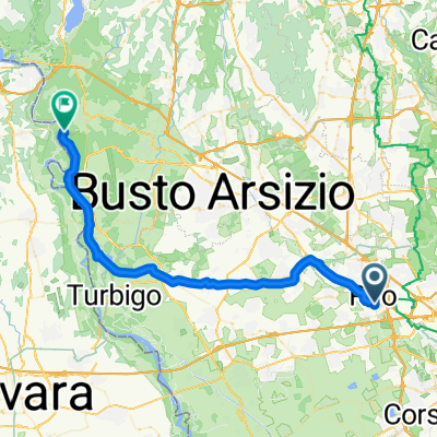
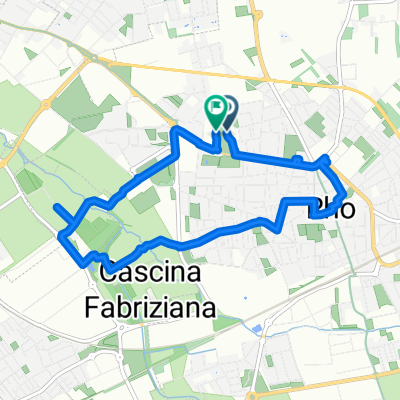
progetto finale bikemap
A cycling route starting in Rho, Lombardy, Italy.
Overview
About this route
- -:--
- Duration
- 19.9 km
- Distance
- 49 m
- Ascent
- 50 m
- Descent
- ---
- Avg. speed
- ---
- Max. altitude

Route quality
Waytypes & surfaces along the route
Waytypes
Quiet road
7.3 km
(37 %)
Cycleway
5.3 km
(27 %)
Surfaces
Paved
8.7 km
(44 %)
Unpaved
0.8 km
(4 %)
Asphalt
7.8 km
(39 %)
Concrete
0.8 km
(4 %)
Route highlights
Points of interest along the route
Point of interest after 0.4 km
Villa Burba
Point of interest after 3.2 km
Parco dei Fontanili
Point of interest after 6.8 km
Parco Lea Garofalo
Point of interest after 12.4 km
Parco Rosa Camuna
Point of interest after 14.7 km
Villa Litta
Continue with Bikemap
Use, edit, or download this cycling route
You would like to ride progetto finale bikemap or customize it for your own trip? Here is what you can do with this Bikemap route:
Free features
- Save this route as favorite or in collections
- Copy & plan your own version of this route
- Sync your route with Garmin or Wahoo
Premium features
Free trial for 3 days, or one-time payment. More about Bikemap Premium.
- Navigate this route on iOS & Android
- Export a GPX / KML file of this route
- Create your custom printout (try it for free)
- Download this route for offline navigation
Discover more Premium features.
Get Bikemap PremiumFrom our community
Other popular routes starting in Rho
 Percorso Naturalistico variante
- Distance
- 22 km
- Ascent
- 53 m
- Descent
- 52 m
- Location
- Rho, Lombardy, Italy
 Da Corso Europa, Rho a Corso Europa, Rho
- Distance
- 7.4 km
- Ascent
- 19 m
- Descent
- 17 m
- Location
- Rho, Lombardy, Italy
 progetto finale bikemap
- Distance
- 19.9 km
- Ascent
- 49 m
- Descent
- 50 m
- Location
- Rho, Lombardy, Italy
 Itinerario storico-artistico rho Variante
- Distance
- 10.2 km
- Ascent
- 32 m
- Descent
- 31 m
- Location
- Rho, Lombardy, Italy
 Rho - Diga del Panperduto
- Distance
- 45.8 km
- Ascent
- 118 m
- Descent
- 84 m
- Location
- Rho, Lombardy, Italy
 Itinerario archeologico Rho variante
- Distance
- 14.6 km
- Ascent
- 47 m
- Descent
- 49 m
- Location
- Rho, Lombardy, Italy
 itinerario storico-artistico rho
- Distance
- 7.9 km
- Ascent
- 15 m
- Descent
- 15 m
- Location
- Rho, Lombardy, Italy
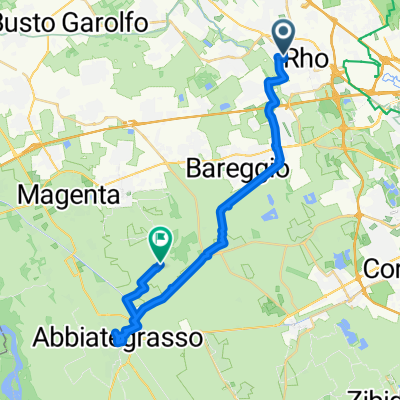 Rho - Abbiategrasso
- Distance
- 30.1 km
- Ascent
- 17 m
- Descent
- 53 m
- Location
- Rho, Lombardy, Italy
Open it in the app