

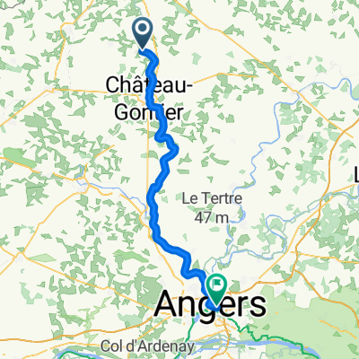
Itinéraire vers ?‰BŸ?
A cycling route starting in Quelaines-Saint-Gault, Pays de la Loire Region, France.
Overview
About this route
- 1 h 24 min
- Duration
- 20 km
- Distance
- 10 m
- Ascent
- 0 m
- Descent
- 14.3 km/h
- Avg. speed
- ---
- Max. altitude
Route quality
Waytypes & surfaces along the route
Waytypes
Path
16.1 km
(80 %)
Track
1 km
(5 %)
Surfaces
Paved
6.6 km
(33 %)
Unpaved
11.8 km
(59 %)
Gravel
7.4 km
(37 %)
Paved (undefined)
5.2 km
(26 %)
Continue with Bikemap
Use, edit, or download this cycling route
You would like to ride Itinéraire vers ?‰BŸ? or customize it for your own trip? Here is what you can do with this Bikemap route:
Free features
- Save this route as favorite or in collections
- Copy & plan your own version of this route
- Sync your route with Garmin or Wahoo
Premium features
Free trial for 3 days, or one-time payment. More about Bikemap Premium.
- Navigate this route on iOS & Android
- Export a GPX / KML file of this route
- Create your custom printout (try it for free)
- Download this route for offline navigation
Discover more Premium features.
Get Bikemap PremiumFrom our community
Other popular routes starting in Quelaines-Saint-Gault
 Chemin de Halage Sud, La Roche-Neuville naar 818 Rue Saint-Léonard, Mayenne
- Distance
- 62.3 km
- Ascent
- 243 m
- Descent
- 179 m
- Location
- Quelaines-Saint-Gault, Pays de la Loire Region, France
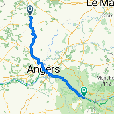
 Quelaines-Saint-Gault - Angers
- Distance
- 68.9 km
- Ascent
- 478 m
- Descent
- 507 m
- Location
- Quelaines-Saint-Gault, Pays de la Loire Region, France
 tours de France sept2021 a
- Distance
- 63.4 km
- Ascent
- 200 m
- Descent
- 260 m
- Location
- Quelaines-Saint-Gault, Pays de la Loire Region, France
 De 1 Rue des Pays de la Loire, Quelaines-Saint-Gault à 4 Chemin de la Benatre, Origné
- Distance
- 7.9 km
- Ascent
- 61 m
- Descent
- 58 m
- Location
- Quelaines-Saint-Gault, Pays de la Loire Region, France
 Quelaines-Saint-Gault - Saumur
- Distance
- 123.8 km
- Ascent
- 908 m
- Descent
- 856 m
- Location
- Quelaines-Saint-Gault, Pays de la Loire Region, France
 Itinéraire vers ?‰BŸ?
- Distance
- 20 km
- Ascent
- 10 m
- Descent
- 0 m
- Location
- Quelaines-Saint-Gault, Pays de la Loire Region, France
 Quelaines-Saint-Gault - Mayenne
- Distance
- 56.4 km
- Ascent
- 831 m
- Descent
- 787 m
- Location
- Quelaines-Saint-Gault, Pays de la Loire Region, France
Open it in the app