

Terhulpensesteenweg 201, Watermaal-Bosvoorde to Chemin des Quatre Bras, La Hulpe
A cycling route starting in Hoeilaart, Flemish Region, Belgium.
Overview
About this route
- 1 h 31 min
- Duration
- 14.4 km
- Distance
- 155 m
- Ascent
- 183 m
- Descent
- 9.5 km/h
- Avg. speed
- ---
- Max. altitude

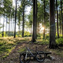
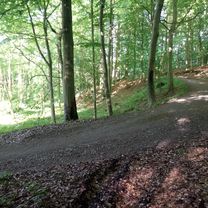
Route photos


Route quality
Waytypes & surfaces along the route
Waytypes
Quiet road
5.8 km
(40 %)
Cycleway
2.9 km
(20 %)
Surfaces
Paved
6.5 km
(45 %)
Unpaved
1.6 km
(11 %)
Asphalt
5.8 km
(40 %)
Gravel
1.6 km
(11 %)
Continue with Bikemap
Use, edit, or download this cycling route
You would like to ride Terhulpensesteenweg 201, Watermaal-Bosvoorde to Chemin des Quatre Bras, La Hulpe or customize it for your own trip? Here is what you can do with this Bikemap route:
Free features
- Save this route as favorite or in collections
- Copy & plan your own version of this route
- Sync your route with Garmin or Wahoo
Premium features
Free trial for 3 days, or one-time payment. More about Bikemap Premium.
- Navigate this route on iOS & Android
- Export a GPX / KML file of this route
- Create your custom printout (try it for free)
- Download this route for offline navigation
Discover more Premium features.
Get Bikemap PremiumFrom our community
Other popular routes starting in Hoeilaart
 14092020
- Distance
- 33.7 km
- Ascent
- 359 m
- Descent
- 361 m
- Location
- Hoeilaart, Flemish Region, Belgium
 Hoeilaart-StGenRode H/T 29
- Distance
- 29.2 km
- Ascent
- 233 m
- Descent
- 232 m
- Location
- Hoeilaart, Flemish Region, Belgium
 Zoniënwoud - H
- Distance
- 54.5 km
- Ascent
- 290 m
- Descent
- 301 m
- Location
- Hoeilaart, Flemish Region, Belgium
 Lost in the woods
- Distance
- 70.4 km
- Ascent
- 304 m
- Descent
- 305 m
- Location
- Hoeilaart, Flemish Region, Belgium
 Friday Ride 14 Aug 20
- Distance
- 20.1 km
- Ascent
- 205 m
- Descent
- 221 m
- Location
- Hoeilaart, Flemish Region, Belgium
 Picnic No Mud 38 S
- Distance
- 37.5 km
- Ascent
- 291 m
- Descent
- 289 m
- Location
- Hoeilaart, Flemish Region, Belgium
 MTB Zoniënwoud
- Distance
- 84.2 km
- Ascent
- 1,182 m
- Descent
- 1,180 m
- Location
- Hoeilaart, Flemish Region, Belgium
 Hoeilaart-StGenRode H/T 22
- Distance
- 21.6 km
- Ascent
- 148 m
- Descent
- 146 m
- Location
- Hoeilaart, Flemish Region, Belgium
Open it in the app