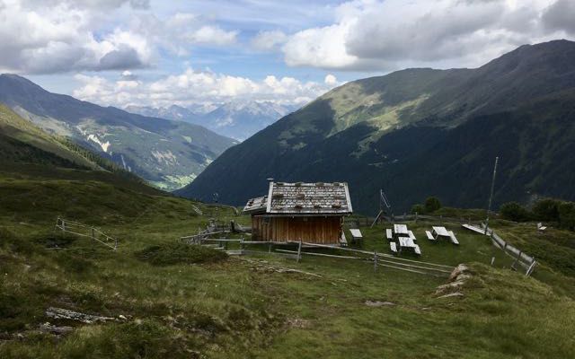
Lüsens - Kogelhütte - Lüsens
A cycling route starting in Gries im Sellrain, Tyrol, Austria.
Overview
About this route
Ausgangspunkt und Zielpunkt ist das Ferienheim St. Georg in Lüsens. Von dort fährt man hinaus zum Alpengasthof Lüsens und von dort weiter talauswärts auf der Straße bis zu Fischteich. Dort biegt man von der Straße links ab zum Fischteich und fährt hinauf zum Alpengasthof Praxmar. Am nördlichen Ende von Praxmar zweigt ein Wald-/Wiesenweg, der im Winter eine Rodelbahn ist, scharf nach links ab und führt hinauf zum Zielpunkt: die Kogelhütte (2135 m).
- -:--
- Duration
- 19.3 km
- Distance
- 677 m
- Ascent
- 677 m
- Descent
- ---
- Avg. speed
- ---
- Max. altitude
Route photos
Continue with Bikemap
Use, edit, or download this cycling route
You would like to ride Lüsens - Kogelhütte - Lüsens or customize it for your own trip? Here is what you can do with this Bikemap route:
Free features
- Save this route as favorite or in collections
- Copy & plan your own version of this route
- Sync your route with Garmin or Wahoo
Premium features
Free trial for 3 days, or one-time payment. More about Bikemap Premium.
- Navigate this route on iOS & Android
- Export a GPX / KML file of this route
- Create your custom printout (try it for free)
- Download this route for offline navigation
Discover more Premium features.
Get Bikemap PremiumFrom our community
Other popular routes starting in Gries im Sellrain
 praxmar - gleischtal - kühtai
- Distance
- 33.9 km
- Ascent
- 1,234 m
- Descent
- 1,401 m
- Location
- Gries im Sellrain, Tyrol, Austria
 Juifenalm
- Distance
- 24.9 km
- Ascent
- 880 m
- Descent
- 880 m
- Location
- Gries im Sellrain, Tyrol, Austria
 Insbruck - Worgl
- Distance
- 95.4 km
- Ascent
- 540 m
- Descent
- 795 m
- Location
- Gries im Sellrain, Tyrol, Austria
 St. Sigmund
- Distance
- 10.8 km
- Ascent
- 746 m
- Descent
- 608 m
- Location
- Gries im Sellrain, Tyrol, Austria
 Gries Besinnungsweg Sellrain
- Distance
- 9.5 km
- Ascent
- 381 m
- Descent
- 384 m
- Location
- Gries im Sellrain, Tyrol, Austria
 Gries im Sellrain nach Kühtai
- Distance
- 8.3 km
- Ascent
- 605 m
- Descent
- 11 m
- Location
- Gries im Sellrain, Tyrol, Austria
 Sankt Sigmund im Sellrain nach Unnamed Road
- Distance
- 6.7 km
- Ascent
- 727 m
- Descent
- 100 m
- Location
- Gries im Sellrain, Tyrol, Austria
 praxmar - pfhütte und zurück
- Distance
- 35.3 km
- Ascent
- 1,504 m
- Descent
- 1,504 m
- Location
- Gries im Sellrain, Tyrol, Austria
Open it in the app


