

Vrancea 1
A cycling route starting in Păulești, Vrancea, Romania.
Overview
About this route
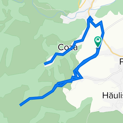
Sat Coza (Lepşa) - Vf. Cristianu
- -:--
- Duration
- 11.3 km
- Distance
- 1,083 m
- Ascent
- 233 m
- Descent
- ---
- Avg. speed
- ---
- Max. altitude

Continue with Bikemap
Use, edit, or download this cycling route
You would like to ride Vrancea 1 or customize it for your own trip? Here is what you can do with this Bikemap route:
Free features
- Save this route as favorite or in collections
- Copy & plan your own version of this route
- Sync your route with Garmin or Wahoo
Premium features
Free trial for 3 days, or one-time payment. More about Bikemap Premium.
- Navigate this route on iOS & Android
- Export a GPX / KML file of this route
- Create your custom printout (try it for free)
- Download this route for offline navigation
Discover more Premium features.
Get Bikemap PremiumFrom our community
Other popular routes starting in Păulești
 drum in vranceaaa
- Distance
- 16 km
- Ascent
- 436 m
- Descent
- 868 m
- Location
- Păulești, Vrancea, Romania
 test legatura
- Distance
- 1.3 km
- Ascent
- 276 m
- Descent
- 53 m
- Location
- Păulești, Vrancea, Romania
 DC71, Hăulişca to DC71, Hăulişca
- Distance
- 19.5 km
- Ascent
- 495 m
- Descent
- 495 m
- Location
- Păulești, Vrancea, Romania
 Vrancea 1
- Distance
- 11.3 km
- Ascent
- 1,083 m
- Descent
- 233 m
- Location
- Păulești, Vrancea, Romania
 13.10
13.10- Distance
- 2.9 km
- Ascent
- 340 m
- Descent
- 38 m
- Location
- Păulești, Vrancea, Romania
 Cascada din Horn
- Distance
- 11.8 km
- Ascent
- 437 m
- Descent
- 229 m
- Location
- Păulești, Vrancea, Romania
 Fundatura-Coza-Lepsa-Coza
- Distance
- 42.4 km
- Ascent
- 1,618 m
- Descent
- 1,621 m
- Location
- Păulești, Vrancea, Romania
Open it in the app