
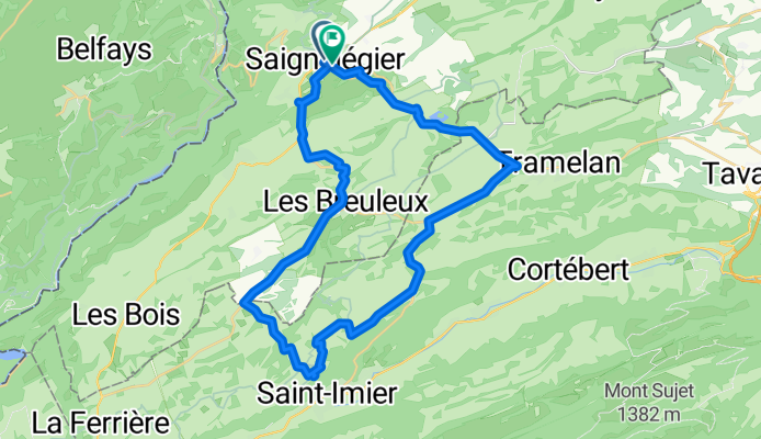
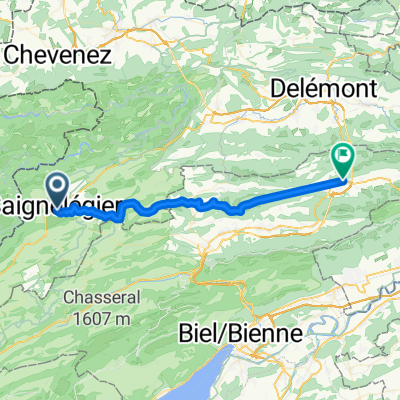
Saignelegier
Rundtour Saignelegier
A cycling route starting in Saignelégier, Canton of Jura, Switzerland.
Overview
About this route
Sagnelegier, Muriaux, Les Emibois, Les Breuleux, Mont soleil, Col du Mont Crosin, Mont-Tramelan, Les Reussilles, Etang de Gruère, Saignelegier
- -:--
- Duration
- 38.1 km
- Distance
- 569 m
- Ascent
- 563 m
- Descent
- ---
- Avg. speed
- ---
- Max. altitude

Part of
Saignelegier
1 stage
Route quality
Waytypes & surfaces along the route
Waytypes
Busy road
19.2 km
(50 %)
Quiet road
7.3 km
(19 %)
Surfaces
Paved
23.1 km
(61 %)
Unpaved
2.3 km
(6 %)
Asphalt
18 km
(47 %)
Paved (undefined)
5 km
(13 %)
Continue with Bikemap
Use, edit, or download this cycling route
You would like to ride Rundtour Saignelegier or customize it for your own trip? Here is what you can do with this Bikemap route:
Free features
- Save this route as favorite or in collections
- Copy & plan your own version of this route
- Sync your route with Garmin or Wahoo
Premium features
Free trial for 3 days, or one-time payment. More about Bikemap Premium.
- Navigate this route on iOS & Android
- Export a GPX / KML file of this route
- Create your custom printout (try it for free)
- Download this route for offline navigation
Discover more Premium features.
Get Bikemap PremiumFrom our community
Other popular routes starting in Saignelégier
 Jura: Geissler - Haller 1. Tag
- Distance
- 31.3 km
- Ascent
- 396 m
- Descent
- 401 m
- Location
- Saignelégier, Canton of Jura, Switzerland
 SBF Tagestour Jura 2011
- Distance
- 56.2 km
- Ascent
- 786 m
- Descent
- 786 m
- Location
- Saignelégier, Canton of Jura, Switzerland
 Breuleux
- Distance
- 59.8 km
- Ascent
- 948 m
- Descent
- 948 m
- Location
- Saignelégier, Canton of Jura, Switzerland
 Place de la Gare 11, Delémont
- Distance
- 56.4 km
- Ascent
- 1,835 m
- Descent
- 2,402 m
- Location
- Saignelégier, Canton of Jura, Switzerland
 Jura Tour: Saignlegier -> Basel
- Distance
- 90.3 km
- Ascent
- 916 m
- Descent
- 1,613 m
- Location
- Saignelégier, Canton of Jura, Switzerland
 Motor Turm
- Distance
- 35.3 km
- Ascent
- 786 m
- Descent
- 1,243 m
- Location
- Saignelégier, Canton of Jura, Switzerland
 Sommer-Bike-Tour 2019 Teil 5
- Distance
- 51.1 km
- Ascent
- 852 m
- Descent
- 1,072 m
- Location
- Saignelégier, Canton of Jura, Switzerland
 Saignelégier - Rundtour
- Distance
- 48.3 km
- Ascent
- 642 m
- Descent
- 646 m
- Location
- Saignelégier, Canton of Jura, Switzerland
Open it in the app