

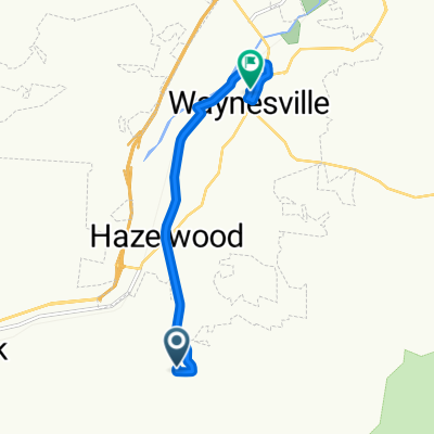
Blue Ridge Crest Views
A cycling route starting in Hazelwood, North Carolina, United States.
Overview
About this route
- -:--
- Duration
- 41.8 km
- Distance
- 720 m
- Ascent
- 738 m
- Descent
- ---
- Avg. speed
- ---
- Max. altitude
Route quality
Waytypes & surfaces along the route
Waytypes
Busy road
40.8 km
(98 %)
Access road
1 km
(2 %)
Continue with Bikemap
Use, edit, or download this cycling route
You would like to ride Blue Ridge Crest Views or customize it for your own trip? Here is what you can do with this Bikemap route:
Free features
- Save this route as favorite or in collections
- Copy & plan your own version of this route
- Sync your route with Garmin or Wahoo
Premium features
Free trial for 3 days, or one-time payment. More about Bikemap Premium.
- Navigate this route on iOS & Android
- Export a GPX / KML file of this route
- Create your custom printout (try it for free)
- Download this route for offline navigation
Discover more Premium features.
Get Bikemap PremiumFrom our community
Other popular routes starting in Hazelwood
 Blue Ridge Crest Views
- Distance
- 41.8 km
- Ascent
- 720 m
- Descent
- 738 m
- Location
- Hazelwood, North Carolina, United States
 NC Bike Route 2 More Direct
- Distance
- 54 km
- Ascent
- 728 m
- Descent
- 1,109 m
- Location
- Hazelwood, North Carolina, United States
 02-Moonshine-Pisgah-37-5479
- Distance
- 59.4 km
- Ascent
- 1,935 m
- Descent
- 1,349 m
- Location
- Hazelwood, North Carolina, United States
 HCBR1
HCBR1- Distance
- 17.2 km
- Ascent
- 317 m
- Descent
- 317 m
- Location
- Hazelwood, North Carolina, United States
 Brown Avenue 945, Waynesville to Brown Avenue 955, Waynesville
- Distance
- 3.7 km
- Ascent
- 61 m
- Descent
- 26 m
- Location
- Hazelwood, North Carolina, United States
 Moderate route in Waynesville
- Distance
- 7.6 km
- Ascent
- 106 m
- Descent
- 200 m
- Location
- Hazelwood, North Carolina, United States
 blue ridge entre cherokee et asheville
- Distance
- 37.3 km
- Ascent
- 736 m
- Descent
- 736 m
- Location
- Hazelwood, North Carolina, United States
 Blue Ridge 50
- Distance
- 50.2 km
- Ascent
- 1,727 m
- Descent
- 1,385 m
- Location
- Hazelwood, North Carolina, United States
Open it in the app