Bahnhofstraße nach Nieder-Ramstädter Straße 181B
- 123 km
- 1,568 m
- 1,571 m
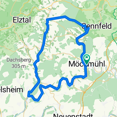
- Möckmühl, Baden-Wurttemberg, Germany
A cycling route starting in Möckmühl, Baden-Wurttemberg, Germany.
Overview
created this 15 years ago
Route quality
Road
15.2 km
14 %
Quiet road
4.4 km
4 %
Paved
87 km
(80 %)
Asphalt
87 km
80 %
Undefined
21.8 km
20 %
Continue with Bikemap
You would like to ride Jagst zur Tauber or customize it for your own trip? Here is what you can do with this Bikemap route:
Free trial for 3 days, or one-time payment. More about Bikemap Premium.
Discover more Premium features.
Get Bikemap PremiumFrom our community
Open it in the app