

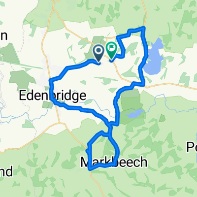
Penny ride 1
A cycling route starting in Edenbridge, England, United Kingdom.
Overview
About this route
easy around edenbridge
- -:--
- Duration
- 22.9 km
- Distance
- 174 m
- Ascent
- 170 m
- Descent
- ---
- Avg. speed
- ---
- Max. altitude

Route quality
Waytypes & surfaces along the route
Waytypes
Quiet road
20.4 km
(89 %)
Road
1.1 km
(5 %)
Undefined
1.4 km
(6 %)
Surfaces
Paved
1.8 km
(8 %)
Asphalt
1.8 km
(8 %)
Undefined
21.1 km
(92 %)
Continue with Bikemap
Use, edit, or download this cycling route
You would like to ride Penny ride 1 or customize it for your own trip? Here is what you can do with this Bikemap route:
Free features
- Save this route as favorite or in collections
- Copy & plan your own version of this route
- Sync your route with Garmin or Wahoo
Premium features
Free trial for 3 days, or one-time payment. More about Bikemap Premium.
- Navigate this route on iOS & Android
- Export a GPX / KML file of this route
- Create your custom printout (try it for free)
- Download this route for offline navigation
Discover more Premium features.
Get Bikemap PremiumFrom our community
Other popular routes starting in Edenbridge
 Work 1: Haxted, Hever, Mark Beach
- Distance
- 19.4 km
- Ascent
- 148 m
- Descent
- 150 m
- Location
- Edenbridge, England, United Kingdom
 CPlus - Kent Castles
- Distance
- 112.9 km
- Ascent
- 1,192 m
- Descent
- 1,151 m
- Location
- Edenbridge, England, United Kingdom
 Back from 4 Elms (clockwise)
- Distance
- 35.9 km
- Ascent
- 151 m
- Descent
- 151 m
- Location
- Edenbridge, England, United Kingdom
 Penny ride 1
- Distance
- 22.9 km
- Ascent
- 174 m
- Descent
- 170 m
- Location
- Edenbridge, England, United Kingdom
 Edenbridge to weserham
- Distance
- 14.7 km
- Ascent
- 258 m
- Descent
- 183 m
- Location
- Edenbridge, England, United Kingdom
 4 Elms to Woodhatch
- Distance
- 40.4 km
- Ascent
- 325 m
- Descent
- 324 m
- Location
- Edenbridge, England, United Kingdom
 Merle Common to Addington
- Distance
- 31.4 km
- Ascent
- 500 m
- Descent
- 489 m
- Location
- Edenbridge, England, United Kingdom
 Recovered Route
- Distance
- 24.1 km
- Ascent
- 244 m
- Descent
- 237 m
- Location
- Edenbridge, England, United Kingdom
Open it in the app