

Schwäbisch Hall Runde
A cycling route starting in Künzelsau, Baden-Württemberg, Germany.
Overview
About this route
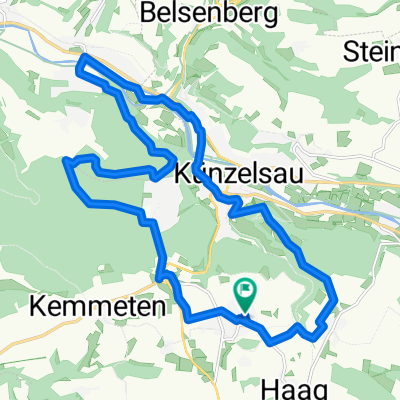
Nach einem Tourenvorschlag unserer Nachbarin Katja ging es Heute von Künzelsau über die alte Bahntrasse hoch nach Kupferzell. In einem ständigen auf und ab geht es durch die Felder in Richtung Schwäbisch Hall. Immer wieder wieder schöne Ausblicke in die Landschaft. In Schwäbisch Hall dann eine ausgiebige Stadtrundfahrt. Eine sehr schöne Altstadt. Sehr sehenswert. Nun zurück über die Radwege entlang der Kocher bis nach Künzelsau und ab in den Biergarten. #noebike
- -:--
- Duration
- 65.3 km
- Distance
- 651 m
- Ascent
- 651 m
- Descent
- ---
- Avg. speed
- ---
- Max. altitude

Route photos


Route quality
Waytypes & surfaces along the route
Waytypes
Track
26.3 km
(40 %)
Quiet road
14.4 km
(22 %)
Surfaces
Paved
59 km
(90 %)
Unpaved
0.1 km
(<1 %)
Asphalt
57.6 km
(88 %)
Paving stones
1 km
(2 %)
Continue with Bikemap
Use, edit, or download this cycling route
You would like to ride Schwäbisch Hall Runde or customize it for your own trip? Here is what you can do with this Bikemap route:
Free features
- Save this route as favorite or in collections
- Copy & plan your own version of this route
- Sync your route with Garmin or Wahoo
Premium features
Free trial for 3 days, or one-time payment. More about Bikemap Premium.
- Navigate this route on iOS & Android
- Export a GPX / KML file of this route
- Create your custom printout (try it for free)
- Download this route for offline navigation
Discover more Premium features.
Get Bikemap PremiumFrom our community
Other popular routes starting in Künzelsau
 BSG STAHL Abschlußfahrt 09
- Distance
- 45.7 km
- Ascent
- 820 m
- Descent
- 756 m
- Location
- Künzelsau, Baden-Württemberg, Germany
 Jagst-Kocher Seitentäler / Hohenloher Ebene
- Distance
- 27.5 km
- Ascent
- 350 m
- Descent
- 351 m
- Location
- Künzelsau, Baden-Württemberg, Germany
 künzelsauer Runde 2
- Distance
- 20.6 km
- Ascent
- 316 m
- Descent
- 316 m
- Location
- Künzelsau, Baden-Württemberg, Germany
 Künzelsau - Ernsbach
- Distance
- 16 km
- Ascent
- 49 m
- Descent
- 82 m
- Location
- Künzelsau, Baden-Württemberg, Germany
 Taläcker SHA via Waldenburg
- Distance
- 29.3 km
- Ascent
- 156 m
- Descent
- 275 m
- Location
- Künzelsau, Baden-Württemberg, Germany
 Döttingen-Künzelsau
- Distance
- 19.1 km
- Ascent
- 174 m
- Descent
- 184 m
- Location
- Künzelsau, Baden-Württemberg, Germany
 Kocherstetten (37,7 km)
- Distance
- 38.1 km
- Ascent
- 620 m
- Descent
- 620 m
- Location
- Künzelsau, Baden-Württemberg, Germany
 Jagst-Radweg und historische Hohe Straße
- Distance
- 138.4 km
- Ascent
- 1,535 m
- Descent
- 1,585 m
- Location
- Künzelsau, Baden-Württemberg, Germany
Open it in the app