

Stein-Bockenheim - Schneebergerhof Runde
A cycling route starting in Stein-Bockenheim, Rhineland-Palatinate, Germany.
Overview
About this route
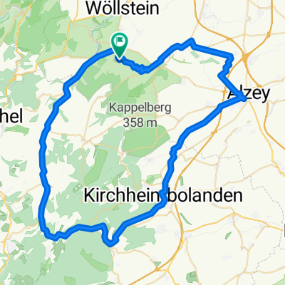
Von Stein-Bockenheim über Wonsheim, Hof Iben ins Appelbachtal. Dort dann bis Gerbach. In St.Alban sind 'Null Energie Häuser' auf dem Berg rechterhand ... sehr sehenswert. In Gerbach dann scharf links ab zum Schneeberger Hof hoch. Dort steht Deutschlands grösstes Windrad ... 6 MW Klasse (JuWi) . Die zugehörige Solarfarm ist nicht zu sehen von der Strasse aus. Durch den Wald nach Kriegsfeld und über Niederwiesen / Wendelsheim wieder nach Hause zurück. Ist eine schöne Trainingsstrecke - ca 40km - alles drin ... flach aber auch mit starkem Anstieg und hügelig
- -:--
- Duration
- 40.9 km
- Distance
- 423 m
- Ascent
- 422 m
- Descent
- ---
- Avg. speed
- ---
- Max. altitude

Route quality
Waytypes & surfaces along the route
Waytypes
Road
16.8 km
(41 %)
Track
7 km
(17 %)
Surfaces
Paved
33.5 km
(82 %)
Asphalt
27 km
(66 %)
Paved (undefined)
6.5 km
(16 %)
Undefined
7.4 km
(18 %)
Continue with Bikemap
Use, edit, or download this cycling route
You would like to ride Stein-Bockenheim - Schneebergerhof Runde or customize it for your own trip? Here is what you can do with this Bikemap route:
Free features
- Save this route as favorite or in collections
- Copy & plan your own version of this route
- Sync your route with Garmin or Wahoo
Premium features
Free trial for 3 days, or one-time payment. More about Bikemap Premium.
- Navigate this route on iOS & Android
- Export a GPX / KML file of this route
- Create your custom printout (try it for free)
- Download this route for offline navigation
Discover more Premium features.
Get Bikemap PremiumFrom our community
Other popular routes starting in Stein-Bockenheim
 Mörsfeld - Wendelsheim - Stein-Bockenheim
- Distance
- 14.7 km
- Ascent
- 274 m
- Descent
- 273 m
- Location
- Stein-Bockenheim, Rhineland-Palatinate, Germany
 Stein-Bockenheim- Feuchtbiotop Appelbach
- Distance
- 9.1 km
- Ascent
- 133 m
- Descent
- 135 m
- Location
- Stein-Bockenheim, Rhineland-Palatinate, Germany
 Appelbachtal - Schneebergerhof - Mörsfeld
- Distance
- 35.1 km
- Ascent
- 373 m
- Descent
- 373 m
- Location
- Stein-Bockenheim, Rhineland-Palatinate, Germany
 Stein-Bockenheim - Erlebnisweg & zurück
- Distance
- 18.8 km
- Ascent
- 379 m
- Descent
- 381 m
- Location
- Stein-Bockenheim, Rhineland-Palatinate, Germany
 rheinhessische Schweiz mit Pfalz
- Distance
- 69.3 km
- Ascent
- 594 m
- Descent
- 593 m
- Location
- Stein-Bockenheim, Rhineland-Palatinate, Germany
 Appelbach - Alsenz - Moschel - Glan - Nahe - RUNDE
- Distance
- 82.9 km
- Ascent
- 837 m
- Descent
- 837 m
- Location
- Stein-Bockenheim, Rhineland-Palatinate, Germany
 Appelbach & Hügel 1
- Distance
- 48.9 km
- Ascent
- 438 m
- Descent
- 438 m
- Location
- Stein-Bockenheim, Rhineland-Palatinate, Germany
 Stein-Bockenheim - rheinhessischer Windpark - Wolfsheim
- Distance
- 34.1 km
- Ascent
- 506 m
- Descent
- 508 m
- Location
- Stein-Bockenheim, Rhineland-Palatinate, Germany
Open it in the app