
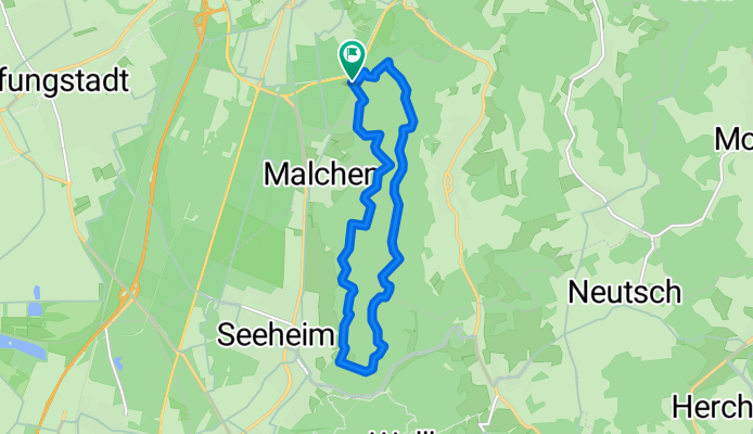
Burg Frankenstein
A cycling route starting in Pfungstadt, Hesse, Germany.
Overview
About this route
- -:--
- Duration
- 11.7 km
- Distance
- 466 m
- Ascent
- 466 m
- Descent
- ---
- Avg. speed
- ---
- Max. altitude
Continue with Bikemap
Use, edit, or download this cycling route
You would like to ride Burg Frankenstein or customize it for your own trip? Here is what you can do with this Bikemap route:
Free features
- Save this route as favorite or in collections
- Copy & plan your own version of this route
- Sync your route with Garmin or Wahoo
Premium features
Free trial for 3 days, or one-time payment. More about Bikemap Premium.
- Navigate this route on iOS & Android
- Export a GPX / KML file of this route
- Create your custom printout (try it for free)
- Download this route for offline navigation
Discover more Premium features.
Get Bikemap PremiumFrom our community
Other popular routes starting in Pfungstadt
 Biebesheim
- Distance
- 9.4 km
- Ascent
- 4 m
- Descent
- 9 m
- Location
- Pfungstadt, Hesse, Germany
 Feierabendtour zum Kühkopf
- Distance
- 31.8 km
- Ascent
- 52 m
- Descent
- 63 m
- Location
- Pfungstadt, Hesse, Germany
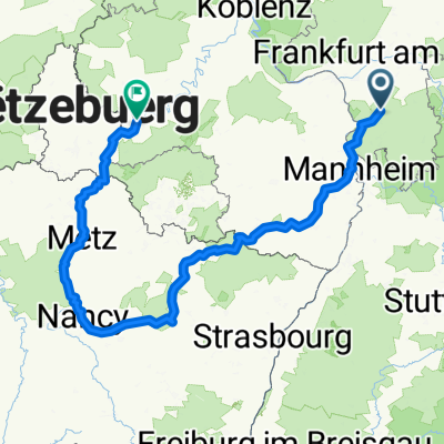 Von Wittring bis Art-sur-Meurthe
- Distance
- 508 km
- Ascent
- 3,404 m
- Descent
- 3,392 m
- Location
- Pfungstadt, Hesse, Germany
 Burg Frankenstein
- Distance
- 11.7 km
- Ascent
- 466 m
- Descent
- 466 m
- Location
- Pfungstadt, Hesse, Germany
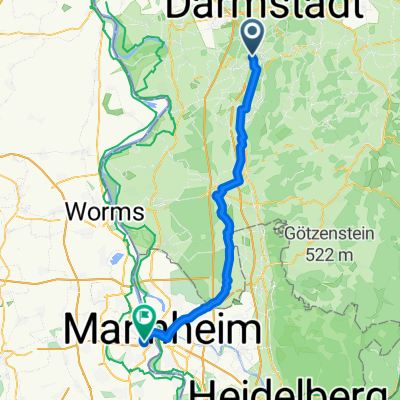 Pfungstadt - Ludwigshafen am Rhein
- Distance
- 53.2 km
- Ascent
- 170 m
- Descent
- 190 m
- Location
- Pfungstadt, Hesse, Germany
 Burg Frankenstein Heppenheim Burg
- Distance
- 64.5 km
- Ascent
- 1,350 m
- Descent
- 1,347 m
- Location
- Pfungstadt, Hesse, Germany
 Feierabendroute zum Bayerischen Biergarten Darmstadt.
- Distance
- 26 km
- Ascent
- 185 m
- Descent
- 183 m
- Location
- Pfungstadt, Hesse, Germany
 2012_Pfungstadt - Frankenstein - Heiligenberg - Steigerts - Hutzelstraße - Col de Ober-Beerbach - Steigerts - Pfungstadt
- Distance
- 49.9 km
- Ascent
- 850 m
- Descent
- 850 m
- Location
- Pfungstadt, Hesse, Germany
Open it in the app