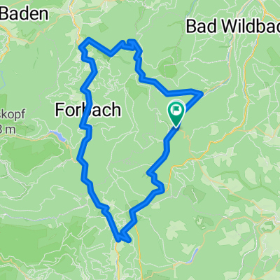
Enz und Eyach
- 49.7 km
- 776 m
- 776 m
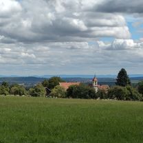
- Enzklösterle, Baden-Wurttemberg, Germany
A cycling route starting in Enzklösterle, Baden-Wurttemberg, Germany.
Overview
For sporty bikers, the approximately 440-kilometer "Bike-X-ing Schwarzwald" from Pforzheim to Bad Säckingen has become a cult classic. The marked route crosses the Black Forest to Bad Säckingen at the Swiss border. It can be divided into any number of daily stages. In total, there are over 16,000 meters of elevation gain to tackle, and average-trained mountain bikers should be able to complete the total route in seven to eight days. Note: The signage for the Bike-Crossing Schwarzwald may have gaps. We recommend digital navigation with a GPS device or the free SchwarzwaldApp.
Route quality
Track
35.5 km
(82 %)
Path
3.9 km
(9 %)
Paved
6.1 km
(14 %)
Unpaved
34.6 km
(80 %)
Gravel
23.8 km
(55 %)
Unpaved (undefined)
6.5 km
(15 %)
Continue with Bikemap
You would like to ride 02_Mittelenztal-Baiersbronn or customize it for your own trip? Here is what you can do with this Bikemap route:
Free trial for 3 days, or one-time payment. More about Bikemap Premium.
Discover more Premium features.
Get Bikemap PremiumFrom our community
Open it in the app