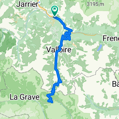
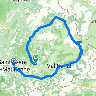
Königsetappe (Galibier+Izoard)
A cycling route starting in Villargondran, Auvergne-Rhône-Alpes, France.
Overview
About this route
Hier heisst es Höhenmeter machen! Landschaftlich sehr reizvolle Gegend. Zu empfehlen ist der Col de Izoard aufgrund des geringen Verkehrsaufkommens und der schönen Landschaft. Auch die Abfahrt gilt es zu genießen! Der schönste Pass für mich bisher.
- -:--
- Duration
- 136.8 km
- Distance
- 3,360 m
- Ascent
- 2,888 m
- Descent
- ---
- Avg. speed
- ---
- Max. altitude
Continue with Bikemap
Use, edit, or download this cycling route
You would like to ride Königsetappe (Galibier+Izoard) or customize it for your own trip? Here is what you can do with this Bikemap route:
Free features
- Save this route as favorite or in collections
- Copy & plan your own version of this route
- Split it into stages to create a multi-day tour
- Sync your route with Garmin or Wahoo
Premium features
Free trial for 3 days, or one-time payment. More about Bikemap Premium.
- Navigate this route on iOS & Android
- Export a GPX / KML file of this route
- Create your custom printout (try it for free)
- Download this route for offline navigation
Discover more Premium features.
Get Bikemap PremiumFrom our community
Other popular routes starting in Villargondran
- ClimbingChallenge2019
- Distance
- 111.1 km
- Ascent
- 3,141 m
- Descent
- 3,140 m
- Location
- Villargondran, Auvergne-Rhône-Alpes, France
- Col du Galibier et Col de la Croix de Fer
- Distance
- 163.9 km
- Ascent
- 3,514 m
- Descent
- 3,511 m
- Location
- Villargondran, Auvergne-Rhône-Alpes, France
- Basique 3
- Distance
- 12.1 km
- Ascent
- 645 m
- Descent
- 146 m
- Location
- Villargondran, Auvergne-Rhône-Alpes, France
- StMichelleMaurienne-Alpe d'Huez-Boug d'Oisan
- Distance
- 107.6 km
- Ascent
- 3,049 m
- Descent
- 2,896 m
- Location
- Villargondran, Auvergne-Rhône-Alpes, France
- basique 1
- Distance
- 8 km
- Ascent
- 516 m
- Descent
- 16 m
- Location
- Villargondran, Auvergne-Rhône-Alpes, France
- Königsetappe (Galibier+Izoard)
- Distance
- 136.8 km
- Ascent
- 3,360 m
- Descent
- 2,888 m
- Location
- Villargondran, Auvergne-Rhône-Alpes, France
- Saint Jean de Maurienne Rochilles Parpaillon
- Distance
- 465.3 km
- Ascent
- 7,303 m
- Descent
- 7,716 m
- Location
- Villargondran, Auvergne-Rhône-Alpes, France
- Col de la Croix de Fer and Col du Glandon
- Distance
- 65.6 km
- Ascent
- 1,676 m
- Descent
- 1,676 m
- Location
- Villargondran, Auvergne-Rhône-Alpes, France
Open it in the app