

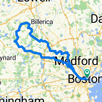
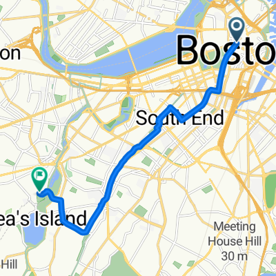
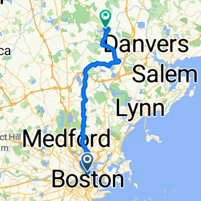
Nahant beach
A cycling route starting in Boston, Massachusetts, United States.
Overview
About this route
- -:--
- Duration
- 18.6 km
- Distance
- 75 m
- Ascent
- 82 m
- Descent
- ---
- Avg. speed
- ---
- Max. altitude
Alexis Regan
created this 5 years ago
Route quality
Waytypes & surfaces along the route
Waytypes
Quiet road
3.9 km
(21 %)
Access road
2.4 km
(13 %)
Surfaces
Paved
8.2 km
(44 %)
Asphalt
7.4 km
(40 %)
Paved (undefined)
0.6 km
(3 %)
Continue with Bikemap
Use, edit, or download this cycling route
You would like to ride Nahant beach or customize it for your own trip? Here is what you can do with this Bikemap route:
Free features
- Save this route as favorite or in collections
- Copy & plan your own version of this route
- Sync your route with Garmin or Wahoo
Premium features
Free trial for 3 days, or one-time payment. More about Bikemap Premium.
- Navigate this route on iOS & Android
- Export a GPX / KML file of this route
- Create your custom printout (try it for free)
- Download this route for offline navigation
Discover more Premium features.
Get Bikemap PremiumFrom our community
Other popular routes starting in Boston
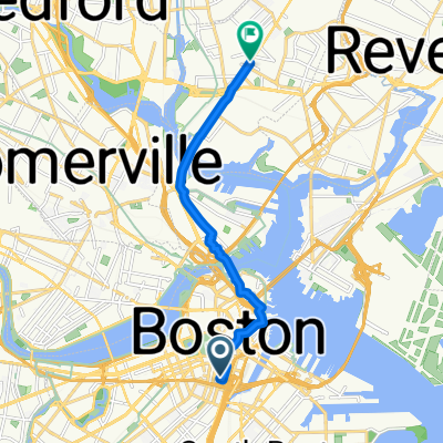
- Home —> Work
- 9.3 km
- 75 m
- 86 m
- Boston, Massachusetts, United States
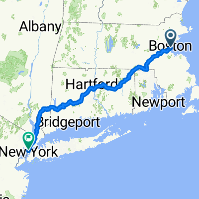
- Putnam - Boston
- 452.7 km
- 4,586 m
- 4,579 m
- Boston, Massachusetts, United States
- Loop to the pond
- 34.1 km
- 351 m
- 356 m
- Boston, Massachusetts, United States
- UA Great Brook Farm
- 100.4 km
- 838 m
- 836 m
- Boston, Massachusetts, United States
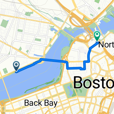
- Pav/North Station
- 3.2 km
- 72 m
- 63 m
- Boston, Massachusetts, United States
- Route to Brookline
- 9 km
- 70 m
- 94 m
- Boston, Massachusetts, United States
- Water St, Boston to Lake St, Middleton
- 36.9 km
- 222 m
- 193 m
- Boston, Massachusetts, United States


Open it in the app