

Oostkantons- legendarische hellingen
A cycling route starting in Sankt Vith, Wallonia, Belgium.
Overview
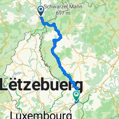
About this route
The tour of the legendary climbs is aimed at well-trained cyclists. With a total distance of 135 km and a profile exceeding 2,000 meters of elevation gain, this route ranks among the most demanding athletic challenges.
- -:--
- Duration
- 131.8 km
- Distance
- 2,413 m
- Ascent
- 2,413 m
- Descent
- ---
- Avg. speed
- ---
- Max. altitude

Route quality
Waytypes & surfaces along the route
Waytypes
Road
40.9 km
(31 %)
Quiet road
17.1 km
(13 %)
Surfaces
Paved
76.4 km
(58 %)
Unpaved
1.3 km
(1 %)
Asphalt
76.4 km
(58 %)
Gravel
1.3 km
(1 %)
Undefined
54 km
(41 %)
Continue with Bikemap
Use, edit, or download this cycling route
You would like to ride Oostkantons- legendarische hellingen or customize it for your own trip? Here is what you can do with this Bikemap route:
Free features
- Save this route as favorite or in collections
- Copy & plan your own version of this route
- Split it into stages to create a multi-day tour
- Sync your route with Garmin or Wahoo
Premium features
Free trial for 3 days, or one-time payment. More about Bikemap Premium.
- Navigate this route on iOS & Android
- Export a GPX / KML file of this route
- Create your custom printout (try it for free)
- Download this route for offline navigation
Discover more Premium features.
Get Bikemap PremiumFrom our community
Other popular routes starting in Sankt Vith
 4 Day St. Vith Pip Margraff - Clervaux Koener
- Distance
- 52.1 km
- Ascent
- 386 m
- Descent
- 507 m
- Location
- Sankt Vith, Wallonia, Belgium
 Vielsalm - Beho - Maldingen - Crombach - Rodt - Skihütte
- Distance
- 44.4 km
- Ascent
- 399 m
- Descent
- 399 m
- Location
- Sankt Vith, Wallonia, Belgium
 Přejezd Německa 23.7.2016
- Distance
- 99.6 km
- Ascent
- 764 m
- Descent
- 780 m
- Location
- Sankt Vith, Wallonia, Belgium
 Route to Wasserbillig
- Distance
- 105.6 km
- Ascent
- 1,583 m
- Descent
- 1,917 m
- Location
- Sankt Vith, Wallonia, Belgium
 L46 (3101) Steinebrück - Pronsfeld
- Distance
- 18.2 km
- Ascent
- 154 m
- Descent
- 161 m
- Location
- Sankt Vith, Wallonia, Belgium
 stukje vennbahn sankt vith Roel2
- Distance
- 52 km
- Ascent
- 520 m
- Descent
- 520 m
- Location
- Sankt Vith, Wallonia, Belgium
 Vennbahn Day 4
- Distance
- 18.9 km
- Ascent
- 280 m
- Descent
- 216 m
- Location
- Sankt Vith, Wallonia, Belgium
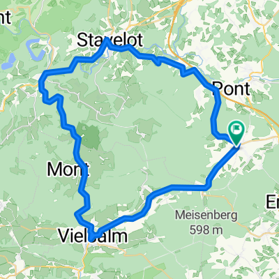 Vielsalm - Trois-Ponts - Stavelot
- Distance
- 45.6 km
- Ascent
- 381 m
- Descent
- 381 m
- Location
- Sankt Vith, Wallonia, Belgium
Open it in the app