
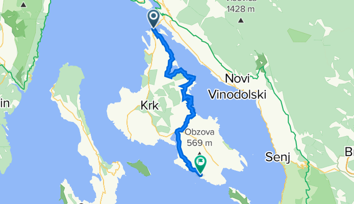
Most Krk-Rudine- Klimno-Šilo-Vrbnik-Punat-S.Baška
A cycling route starting in Omišalj, Primorsko-Goranska Županija, Croatia.
Overview
About this route
- -:--
- Duration
- 54.3 km
- Distance
- 702 m
- Ascent
- 721 m
- Descent
- ---
- Avg. speed
- ---
- Avg. speed

Route quality
Waytypes & surfaces along the route
Waytypes
Busy road
15.7 km
(29 %)
Track
13.9 km
(26 %)
Surfaces
Paved
31.8 km
(59 %)
Unpaved
13.7 km
(25 %)
Asphalt
31.6 km
(58 %)
Gravel
8 km
(15 %)
Continue with Bikemap
Use, edit, or download this cycling route
You would like to ride Most Krk-Rudine- Klimno-Šilo-Vrbnik-Punat-S.Baška or customize it for your own trip? Here is what you can do with this Bikemap route:
Free features
- Save this route as favorite or in collections
- Copy & plan your own version of this route
- Sync your route with Garmin or Wahoo
Premium features
Free trial for 3 days, or one-time payment. More about Bikemap Premium.
- Navigate this route on iOS & Android
- Export a GPX / KML file of this route
- Create your custom printout (try it for free)
- Download this route for offline navigation
Discover more Premium features.
Get Bikemap PremiumFrom our community
Other popular routes starting in Omišalj
 Njivice - Rudine
- Distance
- 28.3 km
- Ascent
- 264 m
- Descent
- 266 m
- Location
- Omišalj, Primorsko-Goranska Županija, Croatia
 Omišalj to Primorska cesta 30, Njivice
- Distance
- 42.3 km
- Ascent
- 702 m
- Descent
- 784 m
- Location
- Omišalj, Primorsko-Goranska Županija, Croatia
 Girolibero: Quarnaro per famiglie
- Distance
- 417.7 km
- Ascent
- 809 m
- Descent
- 786 m
- Location
- Omišalj, Primorsko-Goranska Županija, Croatia
 Ulica Pušća 150, Omišalj to Ulica Pušća 150, Omišalj
- Distance
- 32.2 km
- Ascent
- 368 m
- Descent
- 433 m
- Location
- Omišalj, Primorsko-Goranska Županija, Croatia
 krk kratko
- Distance
- 32.3 km
- Ascent
- 274 m
- Descent
- 356 m
- Location
- Omišalj, Primorsko-Goranska Županija, Croatia
 Po Krku z Nejcem
- Distance
- 54.2 km
- Ascent
- 633 m
- Descent
- 633 m
- Location
- Omišalj, Primorsko-Goranska Županija, Croatia
 44. (GPS) Biciklijada CoolTura 29.09.2012.
- Distance
- 38.4 km
- Ascent
- 403 m
- Descent
- 403 m
- Location
- Omišalj, Primorsko-Goranska Županija, Croatia
 Most Krk - Lič - Zlobin
- Distance
- 51.2 km
- Ascent
- 1,337 m
- Descent
- 1,336 m
- Location
- Omišalj, Primorsko-Goranska Županija, Croatia
Open it in the app