

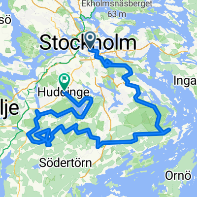
Ekero
A cycling route starting in Stockholm, Stockholm County, Sweden.
Overview
About this route
Dang Fast Route
- -:--
- Duration
- 46.2 km
- Distance
- 259 m
- Ascent
- 285 m
- Descent
- ---
- Avg. speed
- ---
- Max. altitude
Continue with Bikemap
Use, edit, or download this cycling route
You would like to ride Ekero or customize it for your own trip? Here is what you can do with this Bikemap route:
Free features
- Save this route as favorite or in collections
- Copy & plan your own version of this route
- Sync your route with Garmin or Wahoo
Premium features
Free trial for 3 days, or one-time payment. More about Bikemap Premium.
- Navigate this route on iOS & Android
- Export a GPX / KML file of this route
- Create your custom printout (try it for free)
- Download this route for offline navigation
Discover more Premium features.
Get Bikemap PremiumFrom our community
Other popular routes starting in Stockholm
 Loop to the West
- Distance
- 64.9 km
- Ascent
- 268 m
- Descent
- 266 m
- Location
- Stockholm, Stockholm County, Sweden
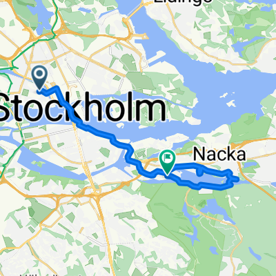
 Wilder Side of Stockholm
- Distance
- 157.4 km
- Ascent
- 1,778 m
- Descent
- 1,780 m
- Location
- Stockholm, Stockholm County, Sweden
 Västmannagatan 46 to Aspviksvägen 28
- Distance
- 28.4 km
- Ascent
- 432 m
- Descent
- 466 m
- Location
- Stockholm, Stockholm County, Sweden
 Stockholm - Dänemark Fähre
- Distance
- 894.8 km
- Ascent
- 618 m
- Descent
- 623 m
- Location
- Stockholm, Stockholm County, Sweden
 Kungsholmen-Brommaplan-Tappström
- Distance
- 19.7 km
- Ascent
- 166 m
- Descent
- 189 m
- Location
- Stockholm, Stockholm County, Sweden
 Olvofsgatan - Vaxholm
- Distance
- 43 km
- Ascent
- 207 m
- Descent
- 227 m
- Location
- Stockholm, Stockholm County, Sweden
 Stockholm with Louise and James.
- Distance
- 14.9 km
- Ascent
- 193 m
- Descent
- 199 m
- Location
- Stockholm, Stockholm County, Sweden
 Decathlon 2
- Distance
- 35.9 km
- Ascent
- 187 m
- Descent
- 186 m
- Location
- Stockholm, Stockholm County, Sweden
Open it in the app