

Ablaßmühle-Kösching
A cycling route starting in Pollenfeld, Bavaria, Germany.
Overview
About this route
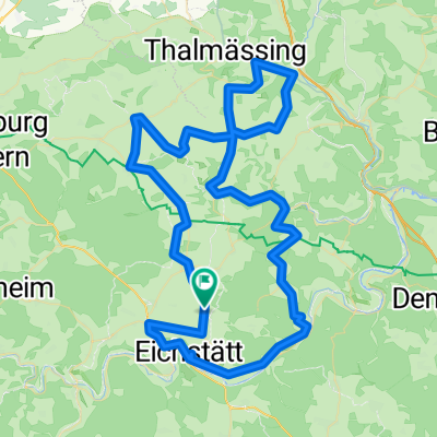
Von der Ablaßmühle (Titting) entlang dem Radlweg nach Kinding. Dort dem Panoramaweg folgend auf die Anhöhe (Hohlweg sehr steil). Irlahüll über Gelbelsee und Denkendorf nach Schönbrunn. Durch den Köschinger Forst nach Kösching.
Im Köschinger Forst evtl. Rast im Waldhaus (m. Spielplatz u. Wildschweingehege). Ansonsten im Forst auch Wildschweine nicht hinter Zäunen.
Wer Lust hat kann noch den Königsberg suchen. Den Markierungsstein auf dem höchsten Punkt habe ich auch nach etlichen Versuchen noch nicht finden können.
- -:--
- Duration
- 43.5 km
- Distance
- 381 m
- Ascent
- 426 m
- Descent
- ---
- Avg. speed
- ---
- Max. altitude

Route quality
Waytypes & surfaces along the route
Waytypes
Track
25.1 km
(58 %)
Road
5.4 km
(12 %)
Surfaces
Paved
14.9 km
(34 %)
Unpaved
26.6 km
(61 %)
Gravel
24.8 km
(57 %)
Asphalt
14.7 km
(34 %)
Continue with Bikemap
Use, edit, or download this cycling route
You would like to ride Ablaßmühle-Kösching or customize it for your own trip? Here is what you can do with this Bikemap route:
Free features
- Save this route as favorite or in collections
- Copy & plan your own version of this route
- Sync your route with Garmin or Wahoo
Premium features
Free trial for 3 days, or one-time payment. More about Bikemap Premium.
- Navigate this route on iOS & Android
- Export a GPX / KML file of this route
- Create your custom printout (try it for free)
- Download this route for offline navigation
Discover more Premium features.
Get Bikemap PremiumFrom our community
Other popular routes starting in Pollenfeld
 Ablaßmühltour 2013
- Distance
- 43.5 km
- Ascent
- 506 m
- Descent
- 512 m
- Location
- Pollenfeld, Bavaria, Germany
 Titting W Burgruine Brunneck
- Distance
- 6.5 km
- Ascent
- 118 m
- Descent
- 79 m
- Location
- Pollenfeld, Bavaria, Germany
 Ins Frankenland Rennrad
- Distance
- 119 km
- Ascent
- 839 m
- Descent
- 839 m
- Location
- Pollenfeld, Bavaria, Germany
 Ablaßmühle-Kösching
- Distance
- 43.5 km
- Ascent
- 381 m
- Descent
- 426 m
- Location
- Pollenfeld, Bavaria, Germany
 Rennrad Thalmässing
- Distance
- 93 km
- Ascent
- 650 m
- Descent
- 650 m
- Location
- Pollenfeld, Bavaria, Germany
 nette Feierabendrunde
- Distance
- 56.6 km
- Ascent
- 589 m
- Descent
- 669 m
- Location
- Pollenfeld, Bavaria, Germany
 Kinding Morsbach Titting Kinding
- Distance
- 56 km
- Ascent
- 382 m
- Descent
- 374 m
- Location
- Pollenfeld, Bavaria, Germany
 Jakobsweg Nürnberg-Eichstätt MTB
- Distance
- 94 km
- Ascent
- 461 m
- Descent
- 673 m
- Location
- Pollenfeld, Bavaria, Germany
Open it in the app