Tour: Iron Curtain Germany (ridden 2020)
Grünes Band DE 03/14: Kirchberg - Gumpertsreuth
A cycling route starting in Kirchberg, Saxony, Germany.
Overview
About this route
18.05.2020 (Mon.) Kirchberg - Irfersgrün - Waldkirchen - Wolfspfütz - Wetzelsgrün - Thoßfell - Kleinfriesen (Plauen) - Oberlosa - Oelsnitz - Obertriebel - Mittelhammer - Trogenau - Oberhartmannsreuth - Gumpertsreuth
It is a part of the route »Iron Curtain Germany«. All Routes in Collection: »Tour: Grünes Band Deutschland«
← (previous) Grünes Band DE 02/14: Freiberg - Kirchberg
→ (next) Grünes Band DE 04/14: Gumpertsreuth - Lauenstein
Route: 79.03 km Travel time: 6:20 hrs Ø Speed: 12.45 km/h Max Speed: 51.65 km/h
- -:--
- Duration
- 75 km
- Distance
- 1,280 m
- Ascent
- 1,092 m
- Descent
- ---
- Avg. speed
- ---
- Max. altitude
Part of
Route photos
Route quality
Waytypes & surfaces along the route
Waytypes
Road
26.3 km
(35 %)
Quiet road
24.8 km
(33 %)
Surfaces
Paved
39 km
(52 %)
Unpaved
6.8 km
(9 %)
Asphalt
36.8 km
(49 %)
Gravel
3 km
(4 %)
Route highlights
Points of interest along the route

Point of interest after 0 km
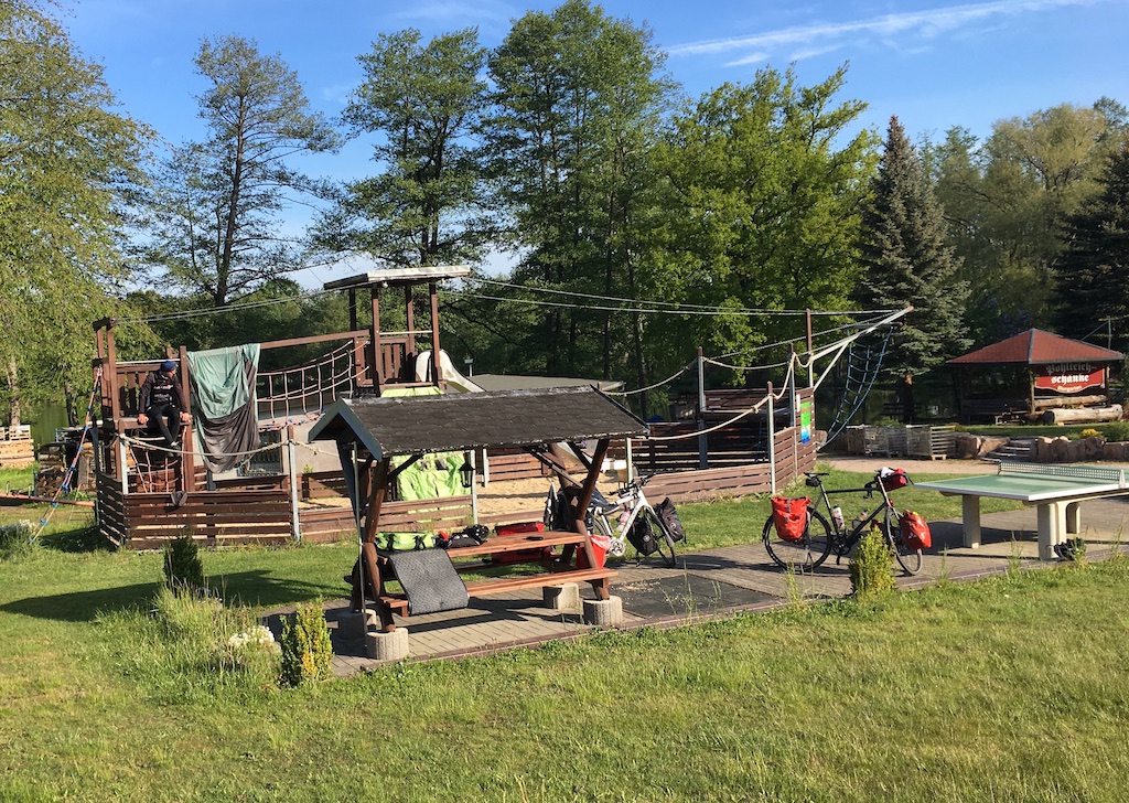
Pohlteichschänke (www.pohlteich.de)
Drinking water after 1.1 km
Breakfast (Frühstück und Kaffee)

Photo after 7.4 km
Ausserhalb der Route

Photo after 7.9 km
Durch die Wiese, da kein Weg eindeutig zu erkennen.
Point of interest after 18.9 km
Ende der schönen ebenen Göltzschtal-Radroute. Ab hier geht es steil nach oben.
Point of interest after 21.5 km
Sehr schmaler Bahnübergang.
Point of interest after 35.2 km
Achtung! Hier ein Paar Meter leicht bergauf auf einer sehr stark befahrenen Bundesstrasse.
Drinking water after 44.3 km
Getränkelanden und Metzger

Point of interest after 60.4 km
Dreiländereck Bis 1989: DDR-BRD-Czech Republic Heute: Sachsen-Bayern-Czech Republic Start der offiziellen Route »Grünes Band Deutschland« (»Iron Curtain Germany«)

Point of interest after 66.9 km
Guter Platz zum Zelten.
Point of interest after 73.4 km
Restaurant und Ferienwohnungen »Altes Haus« (http://alteshaus-markstein.de - Sehr gute Regional-Küche)

Photo after 75 km
Biwak
Continue with Bikemap
Use, edit, or download this cycling route
You would like to ride Grünes Band DE 03/14: Kirchberg - Gumpertsreuth or customize it for your own trip? Here is what you can do with this Bikemap route:
Free features
- Save this route as favorite or in collections
- Copy & plan your own version of this route
- Sync your route with Garmin or Wahoo
Premium features
Free trial for 3 days, or one-time payment. More about Bikemap Premium.
- Navigate this route on iOS & Android
- Export a GPX / KML file of this route
- Create your custom printout (try it for free)
- Download this route for offline navigation
Discover more Premium features.
Get Bikemap PremiumFrom our community
Other popular routes starting in Kirchberg
 HGR-15
- Distance
- 51 km
- Ascent
- 701 m
- Descent
- 701 m
- Location
- Kirchberg, Saxony, Germany
 HGR-10
- Distance
- 55.9 km
- Ascent
- 744 m
- Descent
- 744 m
- Location
- Kirchberg, Saxony, Germany
 3 Tausender
- Distance
- 154.1 km
- Ascent
- 1,965 m
- Descent
- 1,965 m
- Location
- Kirchberg, Saxony, Germany
 www.steile-wand.de Trainingsrunde
- Distance
- 97.7 km
- Ascent
- 890 m
- Descent
- 893 m
- Location
- Kirchberg, Saxony, Germany
 HGR-13
- Distance
- 41.1 km
- Ascent
- 504 m
- Descent
- 504 m
- Location
- Kirchberg, Saxony, Germany
 Kirchberg-Steinberg-Hirschensteine
- Distance
- 34 km
- Ascent
- 530 m
- Descent
- 534 m
- Location
- Kirchberg, Saxony, Germany
 zum Prolog nach Zwickau
- Distance
- 22.5 km
- Ascent
- 102 m
- Descent
- 100 m
- Location
- Kirchberg, Saxony, Germany
 Vater/Sohn ~~~2012/1
- Distance
- 59.3 km
- Ascent
- 423 m
- Descent
- 423 m
- Location
- Kirchberg, Saxony, Germany
Open it in the app


