Tour: Iron Curtain Germany (ridden 2020)
Grünes Band DE 04/14: Gumpertsreuth - Lauenstein
A cycling route starting in Trogen, Bavaria, Germany.
Overview
About this route
19.05.2020 (Di.) Gumpertsreuth - Feilitzsch - Münchenreuth - Mödlareuth - Hirschberg - Rudolfphstein - Eisenbühl - Blankenstein - Schlegel bei Lobenstein - Grumbach - Brennersgrün - Lehesten - Schmiedebach* - Lauenstein*
It is a part of the route »Iron Curtain Germany«. All Routes in Collection: »Tour: Grünes Band Deutschland«
← (previous) Grünes Band DE 03/14: Kirchberg - Gumpertsreuth
→ (next) Grünes Band DE 05/14: Lauenstein - Poppenhausen
Strecke: 73,75 km | Fahrzeit: 5:49 Std | ø Geschwindigkeit: 12,65 km/h | max. Geschwindigkeit: 59,41 km/h
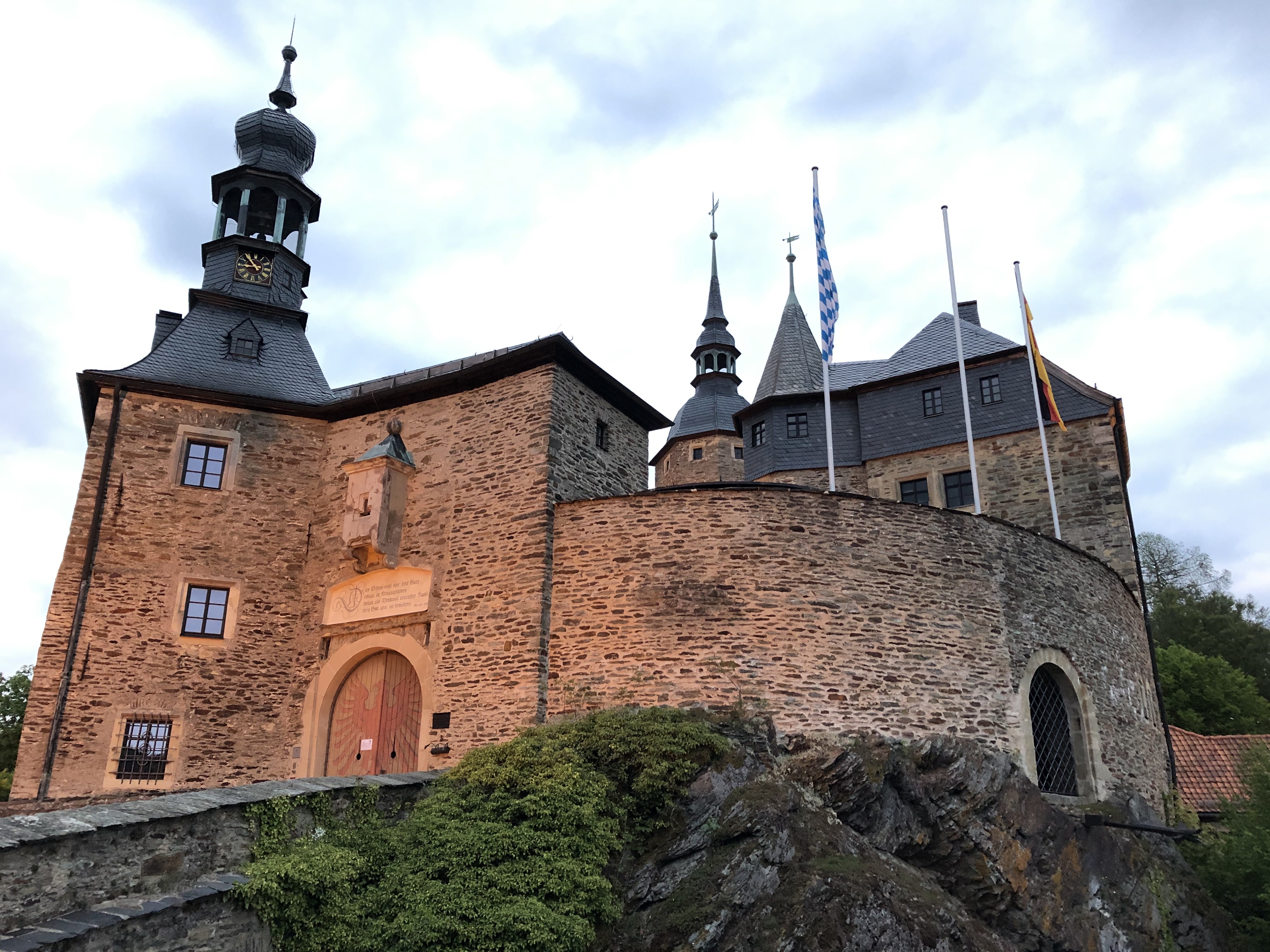
Danksagung an »Graf Marco von Lauenstein« und seine Katze, dass sie uns in der schwierigen COVID-19 Zeit aufgenommen, verpflegt und ihre Burg gezeigt hatten. Danke Marco!
Hinweis: die Strecke ist ziemlich hügelig, aber 2 sehr steile Auffahren sind besonders erwähnenswert:
Schmiedebach
Lauenstein
- -:--
- Duration
- 70 km
- Distance
- 1,423 m
- Ascent
- 1,478 m
- Descent
- ---
- Avg. speed
- ---
- Max. altitude
Part of
Route photos
Route quality
Waytypes & surfaces along the route
Waytypes
Road
29.4 km
(42 %)
Quiet road
9.8 km
(14 %)
Surfaces
Paved
35.7 km
(51 %)
Unpaved
9.1 km
(13 %)
Asphalt
31.5 km
(45 %)
Paved (undefined)
4.2 km
(6 %)
Route highlights
Points of interest along the route

Point of interest after 11.4 km
Museum der Deutsch-Deutschen Teilung

Point of interest after 12.1 km
Panzer

Point of interest after 16.9 km
20%
Drinking water after 24.5 km
Gasthof zum Gumpfen (www.gasthof-zum-gupfen.de)
Drinking water after 47.8 km
Italienisches Restaurant (wg. Covid-19 geschlossen)
Drinking water after 48 km
Gasthaus 'Zum Frankenwald' (auch in der 'COVID-19-Zeit' offen.
Point of interest after 50.8 km
Rennsteighaus https://www.rennsteig.de
Point of interest after 55.2 km
Café
Point of interest after 58.4 km
Smiedebach. Sehr steil !
Point of interest after 61.9 km
Beginn einer langen Abfahrt (Waldweg) bis B85 (Fluss Loquitz)
Point of interest after 69.3 km
Sehr steil bis zur Burg Lauenstein.

Point of interest after 69.8 km
Burg Lauenstein
Drinking water after 70 km
Gasthaus »Goldner Löwe« unterhalb der Burg Lauenstein http://www.goldner-loewe.net
Continue with Bikemap
Use, edit, or download this cycling route
You would like to ride Grünes Band DE 04/14: Gumpertsreuth - Lauenstein or customize it for your own trip? Here is what you can do with this Bikemap route:
Free features
- Save this route as favorite or in collections
- Copy & plan your own version of this route
- Sync your route with Garmin or Wahoo
Premium features
Free trial for 3 days, or one-time payment. More about Bikemap Premium.
- Navigate this route on iOS & Android
- Export a GPX / KML file of this route
- Create your custom printout (try it for free)
- Download this route for offline navigation
Discover more Premium features.
Get Bikemap PremiumFrom our community
Other popular routes starting in Trogen
 Lohmastraße 14, Trogen nach Lohmastraße 14, Trogen
- Distance
- 37.9 km
- Ascent
- 404 m
- Descent
- 404 m
- Location
- Trogen, Bavaria, Germany
 dröda, oberhartmannsreuth 40km
- Distance
- 40.1 km
- Ascent
- 604 m
- Descent
- 604 m
- Location
- Trogen, Bavaria, Germany
 Hauptstraße 8, Trogen nach Burgstadlweg 2, Köditz
- Distance
- 11.7 km
- Ascent
- 96 m
- Descent
- 129 m
- Location
- Trogen, Bavaria, Germany
 Lohmastraße 14, Trogen nach Lohmastraße 16, Trogen
- Distance
- 47.8 km
- Ascent
- 635 m
- Descent
- 635 m
- Location
- Trogen, Bavaria, Germany
 Am Gäßlein 5, Trogen nach Trogen
- Distance
- 11,645.2 km
- Ascent
- 156 m
- Descent
- 114 m
- Location
- Trogen, Bavaria, Germany
 Grünes Band DE 04/14: Gumpertsreuth - Lauenstein
- Distance
- 70 km
- Ascent
- 1,423 m
- Descent
- 1,478 m
- Location
- Trogen, Bavaria, Germany
 Lohmastraße 14, Trogen nach Lohmastraße 14, Trogen
- Distance
- 30 km
- Ascent
- 404 m
- Descent
- 404 m
- Location
- Trogen, Bavaria, Germany
 Lohmastraße 16, Trogen nach Lohmastraße 14, Trogen
- Distance
- 14.3 km
- Ascent
- 139 m
- Descent
- 139 m
- Location
- Trogen, Bavaria, Germany
Open it in the app


