

Ab Oestrich Nr. 1
A cycling route starting in Oestrich-Winkel, Rhineland-Palatinate, Germany.
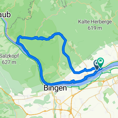
Overview
About this route
Am Schloss Vollrads vorbei, an den Waldäckern vorbei, am Hang bergauf ins Tal rein und dann im Tal links des Elsterbaches zurück zum Kloster Mariental und durch die Weinhänge wieder zurück.
Bitte bewerten, wenn ihr die Runde gefahren seid!
- -:--
- Duration
- 21.1 km
- Distance
- 438 m
- Ascent
- 424 m
- Descent
- ---
- Avg. speed
- 324 m
- Max. altitude

Route quality
Waytypes & surfaces along the route
Waytypes
Track
12 km
(57 %)
Quiet road
5.8 km
(27 %)
Surfaces
Paved
12.2 km
(58 %)
Unpaved
7 km
(33 %)
Asphalt
8.5 km
(41 %)
Unpaved (undefined)
3.7 km
(17 %)
Continue with Bikemap
Use, edit, or download this cycling route
You would like to ride Ab Oestrich Nr. 1 or customize it for your own trip? Here is what you can do with this Bikemap route:
Free features
- Save this route as favorite or in collections
- Copy & plan your own version of this route
- Sync your route with Garmin or Wahoo
Premium features
Free trial for 3 days, or one-time payment. More about Bikemap Premium.
- Navigate this route on iOS & Android
- Export a GPX / KML file of this route
- Create your custom printout (try it for free)
- Download this route for offline navigation
Discover more Premium features.
Get Bikemap PremiumFrom our community
Other popular routes starting in Oestrich-Winkel
 Monte Presso
- Distance
- 47 km
- Ascent
- 599 m
- Descent
- 598 m
- Location
- Oestrich-Winkel, Rhineland-Palatinate, Germany
 2017.02.26_Rheinrunde
- Distance
- 54.1 km
- Ascent
- 28 m
- Descent
- 27 m
- Location
- Oestrich-Winkel, Rhineland-Palatinate, Germany
 Vordertaunus-Wispertal
- Distance
- 57.3 km
- Ascent
- 735 m
- Descent
- 735 m
- Location
- Oestrich-Winkel, Rhineland-Palatinate, Germany
 Route zu Kloster Johannisberg
- Distance
- 28.6 km
- Ascent
- 364 m
- Descent
- 364 m
- Location
- Oestrich-Winkel, Rhineland-Palatinate, Germany
 Sonntagsrunde mit Kathrin
- Distance
- 20.3 km
- Ascent
- 300 m
- Descent
- 300 m
- Location
- Oestrich-Winkel, Rhineland-Palatinate, Germany
 Route in Geisenheim
- Distance
- 34.4 km
- Ascent
- 502 m
- Descent
- 502 m
- Location
- Oestrich-Winkel, Rhineland-Palatinate, Germany
 Rheingau 1
- Distance
- 33 km
- Ascent
- 182 m
- Descent
- 182 m
- Location
- Oestrich-Winkel, Rhineland-Palatinate, Germany
 Fugplatz Finthen
- Distance
- 38 km
- Ascent
- 187 m
- Descent
- 188 m
- Location
- Oestrich-Winkel, Rhineland-Palatinate, Germany
Open it in the app