

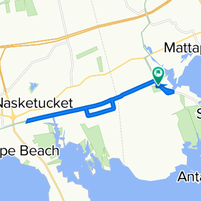
Easy ride in Fairhaven
A cycling route starting in Mattapoisett, Massachusetts, United States.
Overview
About this route
- 26 min
- Duration
- 7.4 km
- Distance
- 61 m
- Ascent
- 58 m
- Descent
- 17 km/h
- Avg. speed
- ---
- Max. altitude

Route quality
Waytypes & surfaces along the route
Waytypes
Cycleway
6 km
(81 %)
Quiet road
0.7 km
(9 %)
Surfaces
Paved
6 km
(81 %)
Asphalt
6 km
(81 %)
Undefined
1.4 km
(19 %)
Continue with Bikemap
Use, edit, or download this cycling route
You would like to ride Easy ride in Fairhaven or customize it for your own trip? Here is what you can do with this Bikemap route:
Free features
- Save this route as favorite or in collections
- Copy & plan your own version of this route
- Sync your route with Garmin or Wahoo
Premium features
Free trial for 3 days, or one-time payment. More about Bikemap Premium.
- Navigate this route on iOS & Android
- Export a GPX / KML file of this route
- Create your custom printout (try it for free)
- Download this route for offline navigation
Discover more Premium features.
Get Bikemap PremiumFrom our community
Other popular routes starting in Mattapoisett
 32 Mattapoisett Neck Rd, Mattapoisett to 32 Mattapoisett Neck Rd, Mattapoisett
- Distance
- 9.5 km
- Ascent
- 41 m
- Descent
- 47 m
- Location
- Mattapoisett, Massachusetts, United States
 marys wolf loop
- Distance
- 38.6 km
- Ascent
- 105 m
- Descent
- 106 m
- Location
- Mattapoisett, Massachusetts, United States
 32 Mattapoisett Neck Rd, Mattapoisett to 32 Mattapoisett Neck Rd, Mattapoisett
- Distance
- 3.5 km
- Ascent
- 104 m
- Descent
- 112 m
- Location
- Mattapoisett, Massachusetts, United States
 27 Mattapoisett Neck Rd, Mattapoisett to 32 Mattapoisett Neck Rd, Mattapoisett
- Distance
- 14.8 km
- Ascent
- 58 m
- Descent
- 60 m
- Location
- Mattapoisett, Massachusetts, United States
 Fairhaven Bike Path 1 Way
- Distance
- 6.4 km
- Ascent
- 0 m
- Descent
- 8 m
- Location
- Mattapoisett, Massachusetts, United States
 Easy ride in Fairhaven
- Distance
- 7.4 km
- Ascent
- 61 m
- Descent
- 58 m
- Location
- Mattapoisett, Massachusetts, United States
 32 Mattapoisett Neck Rd, Mattapoisett to 540 Main St, Acushnet
- Distance
- 11.4 km
- Ascent
- 57 m
- Descent
- 37 m
- Location
- Mattapoisett, Massachusetts, United States
 1 Timberledge Ln, Mattapoisett to 32 Mattapoisett Neck Rd, Mattapoisett
- Distance
- 13.4 km
- Ascent
- 69 m
- Descent
- 70 m
- Location
- Mattapoisett, Massachusetts, United States
Open it in the app