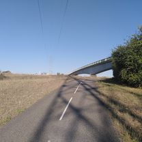
Etape 3 : La Roche de Glun ==> Montélimar
A cycling route starting in La Roche-de-Glun, Auvergne-RhĂ´ne-Alpes, France.
Overview
About this route
- -:--
- Duration
- 79 km
- Distance
- 75 m
- Ascent
- 110 m
- Descent
- ---
- Avg. speed
- ---
- Avg. speed
Route quality
Waytypes & surfaces along the route
Waytypes
Cycleway
44.1 km
(56 %)
Quiet road
16.6 km
(21 %)
Surfaces
Paved
43.2 km
(55 %)
Unpaved
2.3 km
(3 %)
Asphalt
42.6 km
(54 %)
Loose gravel
1.2 km
(2 %)
Continue with Bikemap
Use, edit, or download this cycling route
You would like to ride Etape 3 : La Roche de Glun ==> Montélimar or customize it for your own trip? Here is what you can do with this Bikemap route:
Free features
- Save this route as favorite or in collections
- Copy & plan your own version of this route
- Sync your route with Garmin or Wahoo
Premium features
Free trial for 3 days, or one-time payment. More about Bikemap Premium.
- Navigate this route on iOS & Android
- Export a GPX / KML file of this route
- Create your custom printout (try it for free)
- Download this route for offline navigation
Discover more Premium features.
Get Bikemap PremiumFrom our community
Other popular routes starting in La Roche-de-Glun
- Valence-Monaco Flaka+Stephi
- Distance
- 573.5 km
- Ascent
- 7,391 m
- Descent
- 7,501 m
- Location
- La Roche-de-Glun, Auvergne-RhĂ´ne-Alpes, France
- 2 Allée du Vallon Ensoleillé, Pont-de-l'Isère à 4 Allée du Vallon Ensoleillé, Pont-de-l'Isère
- Distance
- 10.2 km
- Ascent
- 26 m
- Descent
- 16 m
- Location
- La Roche-de-Glun, Auvergne-RhĂ´ne-Alpes, France
- hkhk
- Distance
- 113.4 km
- Ascent
- 725 m
- Descent
- 221 m
- Location
- La Roche-de-Glun, Auvergne-RhĂ´ne-Alpes, France
- Etape 3 : La Roche de Glun ==> Montélimar
- Distance
- 79 km
- Ascent
- 75 m
- Descent
- 110 m
- Location
- La Roche-de-Glun, Auvergne-RhĂ´ne-Alpes, France
- Glun Glun 19 avril
- Distance
- 24.3 km
- Ascent
- 49 m
- Descent
- 51 m
- Location
- La Roche-de-Glun, Auvergne-RhĂ´ne-Alpes, France
- La Roche-De-Glun til Pont St-Esperit
- Distance
- 123.5 km
- Ascent
- 165 m
- Descent
- 232 m
- Location
- La Roche-de-Glun, Auvergne-RhĂ´ne-Alpes, France
- 2014_E11_La Roche-de-Glun_Viviers
- Distance
- 84.7 km
- Ascent
- 94 m
- Descent
- 137 m
- Location
- La Roche-de-Glun, Auvergne-RhĂ´ne-Alpes, France
- ETAPPE 8 - Châteauneuf-sur-Isère nach Mondragon
- Distance
- 121.4 km
- Ascent
- 363 m
- Descent
- 439 m
- Location
- La Roche-de-Glun, Auvergne-RhĂ´ne-Alpes, France
Open it in the app