

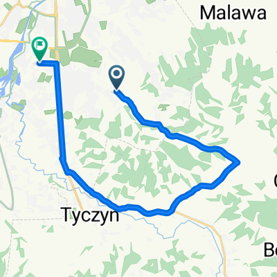
Na wschód od Rzeszowa
A cycling route starting in Tyczyn, Subcarpathian Voivodeship, Poland.
Overview
About this route
Exploring the eastern areas of Rzeszów.
Kraczkowa, Albigowa, Markowa, Sietesz, Manasterz, Jawornik, Szklary, Bachórz (żurek under the traffic light), Dylągówka, Hyżne, Borówki, Chmielnik, Słocina, Matysówka
- -:--
- Duration
- 100.6 km
- Distance
- 632 m
- Ascent
- 629 m
- Descent
- ---
- Avg. speed
- ---
- Max. altitude

Route quality
Waytypes & surfaces along the route
Waytypes
Road
33.2 km
(33 %)
Quiet road
21.1 km
(21 %)
Surfaces
Paved
79.4 km
(79 %)
Asphalt
79.4 km
(79 %)
Undefined
21.1 km
(21 %)
Continue with Bikemap
Use, edit, or download this cycling route
You would like to ride Na wschód od Rzeszowa or customize it for your own trip? Here is what you can do with this Bikemap route:
Free features
- Save this route as favorite or in collections
- Copy & plan your own version of this route
- Split it into stages to create a multi-day tour
- Sync your route with Garmin or Wahoo
Premium features
Free trial for 3 days, or one-time payment. More about Bikemap Premium.
- Navigate this route on iOS & Android
- Export a GPX / KML file of this route
- Create your custom printout (try it for free)
- Download this route for offline navigation
Discover more Premium features.
Get Bikemap PremiumFrom our community
Other popular routes starting in Tyczyn
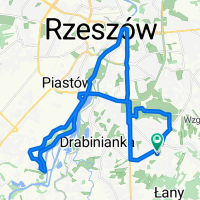
 Krótsza trasa przez Tyczyn
- Distance
- 18.3 km
- Ascent
- 209 m
- Descent
- 209 m
- Location
- Tyczyn, Subcarpathian Voivodeship, Poland
 M Ćwiklińskiej, Rzeszów to M Ćwiklińskiej, Rzeszów
- Distance
- 21.7 km
- Ascent
- 174 m
- Descent
- 174 m
- Location
- Tyczyn, Subcarpathian Voivodeship, Poland
 4A, Matysówka do Zaciszna 5, Rzeszów
- Distance
- 16.9 km
- Ascent
- 124 m
- Descent
- 160 m
- Location
- Tyczyn, Subcarpathian Voivodeship, Poland
 Rzeszów od wschodu
- Distance
- 16.1 km
- Ascent
- 171 m
- Descent
- 171 m
- Location
- Tyczyn, Subcarpathian Voivodeship, Poland
 Odkrywając nowe asfalty wokół Rzeszowa CLONED FROM ROUTE 440448
- Distance
- 113.4 km
- Ascent
- 976 m
- Descent
- 1,095 m
- Location
- Tyczyn, Subcarpathian Voivodeship, Poland
 Matysówka nocą
- Distance
- 21.6 km
- Ascent
- 422 m
- Descent
- 417 m
- Location
- Tyczyn, Subcarpathian Voivodeship, Poland
 Dookola Patrii
- Distance
- 63 km
- Ascent
- 660 m
- Descent
- 682 m
- Location
- Tyczyn, Subcarpathian Voivodeship, Poland
 Niedzielna trasa v1
- Distance
- 11.5 km
- Ascent
- 77 m
- Descent
- 77 m
- Location
- Tyczyn, Subcarpathian Voivodeship, Poland
Open it in the app